Rancho Nuevo geodata
Rancho Nuevo (Morelos) is a populated place; located in Mexico in America/Mexico_City (GMT-6) time zone. With population of 658 people, there are 13187 cities with bigger population in this country. Compared to other cities in Mexico, 72% of cities are located further ↑North; 55.2% of cities are located further →East and 60.2% of cities have higher elevation than Rancho Nuevo. Note1


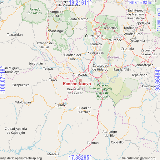
Rancho Nuevo GPS coordinates[2]
18° 33' 2.988" North, 99° 22' 5.016" West
| Map corner | latitude | longitude |
|---|---|---|
| Upper-left | 19.21611°, | -100.07119° |
| Center: | 18.55083°, | -99.36806° |
| Lower-right: | 17.88295°, | -98.66494° |
| Map W x H: | 148.2×148.2 km | = 92.1×92.1mi |
| max Lat: | 32.7° ⇑72% North |
| Rancho Nuevo: | 18.55083° |
| min Lat: | ⇓28% South 14.53588° |
| min Long | Rancho Nuevo | max Long |
| -117.105° | -99.36806° | -86.73105° |
| W 44.8%⇐ | ⇒55.2% E |
Elevation
Elevation of Rancho Nuevo is 987 m = 3238 ft, and this is 266.7 m = 875 ft below average elevation for this country.
| Max E: |
3497 m = 11473 ft | 60.2% |
| Avg. | 1253.7 m = 4113 ft | |
| Rancho Nuevo | 987 m = 3238 ft | |
Min E: |
-1 m = -3 ft | 39.8% |
See also: Mexico elevation on elevation.city.
Geographical zone
Rancho Nuevo is located in North Torrid zone (between Equator and Tropic of Cancer). Distance of this Northern Tropic circle is 543.3 km =337.6 mi to North.| Distance of | km | miles | from Rancho Nuevo |
|---|---|---|---|
| North Pole | 7944.4 | 4936.4 | to North |
| Arctic Circle | 5338.5 | 3317.2 | to North |
| Tropic Cancer | 543.3 | 337.6 | to North |
| Equator | 2062.7 | 1281.7 | to South |


Nearby cities:
15 places around Rancho Nuevo: (largest is in red/bold)
• 24 de Febrero
10.5 km =6.5 mi,  23°
23°
• Amacuzac
5.3 km =3.3 mi,  358°
358°
• Cajones
3.5 km =2.2 mi,  41°
41°
• Casahuatlán
3.4 km =2.1 mi,  315°
315°
• Coahuixtla
2.6 km =1.6 mi, 355°
• El Coco
7.3 km =4.5 mi,  52°
52°
• El Estudiante
8 km =5 mi,  68°
68°
• Huajintlán
8.8 km =5.5 mi, 317°
• Miahuatlán (El Cuiji)
4.6 km =2.9 mi, 19°
• Palmillas
6.9 km =4.3 mi,  242°
242°
• Puente de Ixtla
8.8 km =5.5 mi, 36°
• San Gabriel las Palmas
7.4 km =4.6 mi, 17°
• Santa Fe Tepetlapa
6 km =3.7 mi,  268°
268°
• Tehuixtla
10.3 km =6.4 mi,  84°
84°
• Zacapalco
8.2 km =5.1 mi,  258°
258°
Sources, notices
• [Note1] Compared only with cities in Mexico existing in our database
• [Src1] Map data: © OpenStreetMap contributors (CC-BY-SA)
• [Src2] Other city data from geonames.org with taken over terms of usage.
• [Src3] Geographical zone / Annual Mean Temperature by Robert A. Rohde @ Wikipedia
