San Gabriel las Palmas geodata
San Gabriel las Palmas (Morelos) is a populated place; located in Mexico in America/Mexico_City (GMT-6) time zone. With population of 3,005 people, there are 2988 cities with bigger population in this country. Compared to other cities in Mexico, 71.3% of cities are located further ↑North; 54.8% of cities are located further →East and 61.2% of cities have higher elevation than San Gabriel las Palmas. Note1
Current local time in San Gabriel las Palmas:
08:29 AM, WednesdayDifference from your time zone: hours


San Gabriel las Palmas GPS coordinates[2]
18° 36' 51.012" North, 99° 20' 48.984" West
| Map corner | latitude | longitude |
|---|---|---|
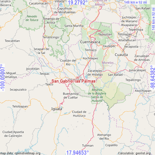
| Upper-left | 19.2792°, | -100.05007° |
| Center: | 18.61417°, | -99.34694° |
| Lower-right: | 17.94653°, | -98.64382° |
| Map W x H: | 148.2×148.2 km | = 92.1×92.1mi |
| max Lat: | 32.7° ⇑71.3% North |
| San Gabriel las Palmas: | 18.61417° |
| min Lat: | ⇓28.7% South 14.53588° |
| min Long | San Gabriel las | max Long |
| -117.105° | -99.34694° | -86.73105° |
| W 45.2%⇐ | ⇒54.8% E |
Elevation
Elevation of San Gabriel las Palmas is 928 m = 3045 ft, and this is 325.7 m = 1069 ft below average elevation for this country.
| Max E: |
3497 m = 11473 ft | 61.2% |
| Avg. | 1253.7 m = 4113 ft | |
| San Gabriel las Palmas | 928 m = 3045 ft | |
Min E: |
-1 m = -3 ft | 38.8% |
See also: Mexico elevation on elevation.city.
Geographical zone
San Gabriel las Palmas is located in North Torrid zone (between Equator and Tropic of Cancer). Distance of this Northern Tropic circle is 536.2 km =333.2 mi to North.| Distance of | km | miles | from San Gabriel las Palmas |
|---|---|---|---|
| North Pole | 7937.4 | 4932.1 | to North |
| Arctic Circle | 5331.5 | 3312.8 | to North |
| Tropic Cancer | 536.2 | 333.2 | to North |
| Equator | 2069.7 | 1286.1 | to South |


Nearby cities:
15 places around San Gabriel las Palmas: (largest is in red/bold)
• 24 de Febrero
3.2 km =2 mi,  37°
37°
• Ahuehuetzingo
8.4 km =5.2 mi,  28°
28°
• Amacuzac
2.9 km =1.8 mi,  233°
233°
• Cajones
4.4 km =2.7 mi,  178°
178°
• Casahuatlán
6.5 km =4 mi,  224°
224°
• Coahuixtla
5.1 km =3.2 mi,  208°
208°
• Cuauchichinola
6.3 km =3.9 mi,  331°
331°
• El Coco
4.4 km =2.7 mi,  126°
126°
• El Estudiante
6.6 km =4.1 mi, 127°
• Huajintlán
8.2 km =5.1 mi,  266°
266°
• Miahuatlán (El Cuiji)
2.8 km =1.7 mi,  194°
194°
• Puente de Ixtla
3 km =1.9 mi,  88°
88°
• Rancho Nuevo
7.4 km =4.6 mi,  197°
197°
• San José Vista Hermosa
9.6 km =6 mi,  62°
62°
• Tequesquitengo
9.1 km =5.7 mi, 92°
Sources, notices
• [Note1] Compared only with cities in Mexico existing in our database
• [Src1] Map data: © OpenStreetMap contributors (CC-BY-SA)
• [Src2] Other city data from geonames.org with taken over terms of usage.
• [Src3] Geographical zone / Annual Mean Temperature by Robert A. Rohde @ Wikipedia
