El Remanso geodata
El Remanso (Veracruz) is a populated place; located in Mexico in America/Mexico_City (GMT-6) time zone. With population of 559 people, there are 15266 cities with bigger population in this country. Compared to other cities in Mexico, 80% of cities are located further ↓South; 59.2% of cities are located further ←West and 83.1% of cities have higher elevation than El Remanso. Note1


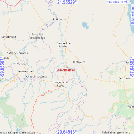
El Remanso GPS coordinates[2]
21° 18' 6.012" North, 98° 21' 6.984" West
| Map corner | latitude | longitude |
|---|---|---|
| Upper-left | 21.95529°, | -99.05507° |
| Center: | 21.30167°, | -98.35194° |
| Lower-right: | 20.64513°, | -97.64882° |
| Map W x H: | 145.7×145.7 km | = 90.5×90.5mi |
| max Lat: | 32.7° ⇑20% North |
| El Remanso: | 21.30167° |
| min Lat: | ⇓80% South 14.53588° |
| min Long | El Remanso | max Long |
| -117.105° | -98.35194° | -86.73105° |
| W 59.2%⇐ | ⇒40.8% E |
Elevation
Elevation of El Remanso is 59 m = 194 ft, and this is 1194.7 m = 3920 ft below average elevation for this country.
| Max E: |
3497 m = 11473 ft | 83.1% |
| Avg. | 1253.7 m = 4113 ft | |
| El Remanso | 59 m = 194 ft | |
Min E: |
-1 m = -3 ft | 16.9% |
See also: Mexico elevation on elevation.city.
Geographical zone
El Remanso is located in North Torrid zone (between Equator and Tropic of Cancer). Distance of this Northern Tropic circle is 237.4 km =147.5 mi to North.| Distance of | km | miles | from El Remanso |
|---|---|---|---|
| North Pole | 7638.5 | 4746.3 | to North |
| Arctic Circle | 5032.7 | 3127.2 | to North |
| Tropic Cancer | 237.4 | 147.5 | to North |
| Equator | 2368.5 | 1471.7 | to South |


Nearby cities:
15 places around El Remanso: (largest is in red/bold)
• Chalma
11.4 km =7.1 mi,  204°
204°
• Chiconamel
13.7 km =8.5 mi,  234°
234°
• Ciruelar Aquiche
12.2 km =7.6 mi,  19°
19°
• El Jobo Aquiche
11.1 km =6.9 mi,  28°
28°
• El Lindero
13.7 km =8.5 mi,  84°
84°
• La Estanzuela
14 km =8.7 mi, 29°
• Las Mesas San Gabriel (Las Mesas)
10.3 km =6.4 mi,  349°
349°
• Palmar Aquiche Primero
12.5 km =7.8 mi, 31°
• Platón Sánchez
4.1 km =2.5 mi,  215°
215°
• Potrero Segundo
10.3 km =6.4 mi,  55°
55°
• San Pedro Coyutla
11.8 km =7.3 mi, 223°
• Tametate
12.5 km =7.8 mi, 81°
• Tepatlán
8.2 km =5.1 mi,  87°
87°
• Trapiche
10.6 km =6.6 mi,  44°
44°
• Xiloxúchitl
9.8 km =6.1 mi, 58°
Sources, notices
• [Note1] Compared only with cities in Mexico existing in our database
• [Src1] Map data: © OpenStreetMap contributors (CC-BY-SA)
• [Src2] Other city data from geonames.org with taken over terms of usage.
• [Src3] Geographical zone / Annual Mean Temperature by Robert A. Rohde @ Wikipedia
