Platón Sánchez geodata
Platón Sánchez (Veracruz) is a seat of a second-order administrative division; located in Mexico in America/Mexico_City (GMT-6) time zone. With population of 10,758 people, there are 882 cities with bigger population in this country. Compared to other cities in Mexico, 79.8% of cities are located further ↓South; 59% of cities are located further ←West and 82% of cities have higher elevation than Platón Sánchez. Note1


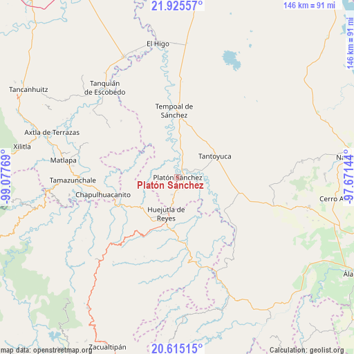
Platón Sánchez GPS coordinates[2]
21° 16' 18.552" North, 98° 22' 28.416" West
| Map corner | latitude | longitude |
|---|---|---|
| Upper-left | 21.92557°, | -99.07769° |
| Center: | 21.27182°, | -98.37456° |
| Lower-right: | 20.61515°, | -97.67144° |
| Map W x H: | 145.7×145.7 km | = 90.5×90.5mi |
| max Lat: | 32.7° ⇑20.2% North |
| Platón Sánchez: | 21.27182° |
| min Lat: | ⇓79.8% South 14.53588° |
| min Long | Platón Sánche | max Long |
| -117.105° | -98.37456° | -86.73105° |
| W 59%⇐ | ⇒41% E |
Elevation
Elevation of Platón Sánchez is 70 m = 230 ft, and this is 1183.7 m = 3884 ft below average elevation for this country.
| Max E: |
3497 m = 11473 ft | 82% |
| Avg. | 1253.7 m = 4113 ft | |
| Platón Sánchez | 70 m = 230 ft | |
Min E: |
-1 m = -3 ft | 18% |
See also: Mexico elevation on elevation.city.
Geographical zone
Platón Sánchez is located in North Torrid zone (between Equator and Tropic of Cancer). Distance of this Northern Tropic circle is 240.7 km =149.6 mi to North.| Distance of | km | miles | from Platón Sánchez |
|---|---|---|---|
| North Pole | 7641.9 | 4748.5 | to North |
| Arctic Circle | 5036 | 3129.2 | to North |
| Tropic Cancer | 240.7 | 149.6 | to North |
| Equator | 2365.2 | 1469.7 | to South |


Nearby cities:
15 places around Platón Sánchez: (largest is in red/bold)
• Chalma
7.4 km =4.6 mi,  199°
199°
• Chiconamel
10 km =6.2 mi,  242°
242°
• Corral Blanco (Todos por Hidalgo)
13.3 km =8.3 mi,  186°
186°
• El Pintor
13.1 km =8.1 mi, 197°
• El Remanso
4.1 km =2.5 mi,  35°
35°
• Las Mesas San Gabriel (Las Mesas)
13.4 km =8.3 mi,  2°
2°
• Las Pilas
13 km =8.1 mi, 193°
• Motoltepec
11.7 km =7.3 mi,  175°
175°
• Parque de Poblamiento Solidaridad
13.4 km =8.3 mi, 185°
• Rancho Viejo
13.5 km =8.4 mi,  154°
154°
• San Pedro Coyutla
7.8 km =4.8 mi,  227°
227°
• Tancazahuela
11.7 km =7.3 mi,  212°
212°
• Tepatlán
11.1 km =6.9 mi,  70°
70°
• Zohuala
12.3 km =7.6 mi,  248°
248°
• Ámaxac
12.4 km =7.7 mi, 239°
Sources, notices
• [Note1] Compared only with cities in Mexico existing in our database
• [Src1] Map data: © OpenStreetMap contributors (CC-BY-SA)
• [Src2] Other city data from geonames.org with taken over terms of usage.
• [Src3] Geographical zone / Annual Mean Temperature by Robert A. Rohde @ Wikipedia
