Cañada Grande geodata
Cañada Grande (Chiapas) is a populated place; located in Mexico in America/Mexico_City (GMT-6) time zone. With population of 544 people, there are 15626 cities with bigger population in this country. Compared to other cities in Mexico, 91.5% of cities are located further ↑North; 91.7% of cities are located further ←West and 80.4% of cities have lower elevation than Cañada Grande. Note1


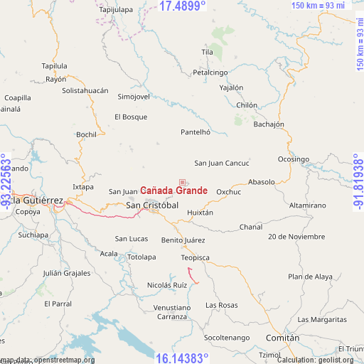
Cañada Grande GPS coordinates[2]
16° 49' 5.016" North, 92° 31' 21" West
| Map corner | latitude | longitude |
|---|---|---|
| Upper-left | 17.4899°, | -93.22563° |
| Center: | 16.81806°, | -92.5225° |
| Lower-right: | 16.14383°, | -91.81938° |
| Map W x H: | 149.7×149.7 km | = 93×93mi |
| max Lat: | 32.7° ⇑91.5% North |
| Cañada Grande: | 16.81806° |
| min Lat: | ⇓8.5% South 14.53588° |
| min Long | Cañada Grande | max Long |
| -117.105° | -92.5225° | -86.73105° |
| W 91.7%⇐ | ⇒8.3% E |
Elevation
Elevation of Cañada Grande is 2151 m = 7057 ft, and this is 897.3 m = 2944 ft above average elevation for this country.
| Max E: |
3497 m = 11473 ft | 19.6% |
| Cañada Grande | 2151 m 7057 ft | |
| Avg. | 1253.7 m = 4113 ft | |
Min E: |
-1 m = -3 ft | 80.4% |
See also: Mexico elevation on elevation.city.
Geographical zone
Cañada Grande is located in North Torrid zone (between Equator and Tropic of Cancer). Distance of this Northern Tropic circle is 735.9 km =457.3 mi to North.| Distance of | km | miles | from Cañada Grande |
|---|---|---|---|
| North Pole | 8137.1 | 5056.2 | to North |
| Arctic Circle | 5531.2 | 3436.9 | to North |
| Tropic Cancer | 735.9 | 457.3 | to North |
| Equator | 1870 | 1162 | to South |


Nearby cities:
15 places around Cañada Grande: (largest is in red/bold)
• Cruzchén
5.6 km =3.5 mi,  76°
76°
• El Crucero
5.1 km =3.2 mi,  247°
247°
• El Pozo
6.5 km =4 mi,  305°
305°
• Jerusalén
6.3 km =3.9 mi,  66°
66°
• Kotolte
3.4 km =2.1 mi,  268°
268°
• Las Ollas
5.2 km =3.2 mi,  218°
218°
• Matzam
5.8 km =3.6 mi,  123°
123°
• Ococh
5.5 km =3.4 mi, 66°
• Oxinam
5.8 km =3.6 mi,  330°
330°
• Pajaltón
2 km =1.2 mi, 333°
• Pajaltón Alto
5.4 km =3.4 mi,  283°
283°
• Pajaltón Bajo
3.9 km =2.4 mi, 306°
• Shishintonil
5.3 km =3.3 mi,  50°
50°
• Tenejapa
1.7 km =1.1 mi,  87°
87°
• Tzontehuitz
6.3 km =3.9 mi,  285°
285°
Sources, notices
• [Note1] Compared only with cities in Mexico existing in our database
• [Src1] Map data: © OpenStreetMap contributors (CC-BY-SA)
• [Src2] Other city data from geonames.org with taken over terms of usage.
• [Src3] Geographical zone / Annual Mean Temperature by Robert A. Rohde @ Wikipedia
