Huauchinango geodata
Huauchinango (Puebla) is a seat of a second-order administrative division; located in Mexico in America/Mexico_City (GMT-6) time zone. With population of 56,206 people, there are 203 cities with bigger population in this country. Compared to other cities in Mexico, 60.8% of cities are located further ↓South; 63% of cities are located further ←West and 52.4% of cities have lower elevation than Huauchinango. Note1


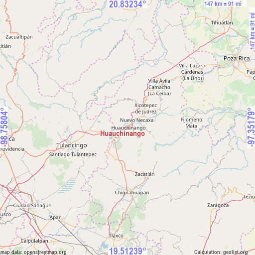
Huauchinango GPS coordinates[2]
20° 10' 25.536" North, 98° 3' 17.676" West
| Map corner | latitude | longitude |
|---|---|---|
| Upper-left | 20.83234°, | -98.75804° |
| Center: | 20.17376°, | -98.05491° |
| Lower-right: | 19.51239°, | -97.35179° |
| Map W x H: | 146.8×146.8 km | = 91.2×91.2mi |
| max Lat: | 32.7° ⇑39.2% North |
| Huauchinango: | 20.17376° |
| min Lat: | ⇓60.8% South 14.53588° |
| min Long | Huauchinango | max Long |
| -117.105° | -98.05491° | -86.73105° |
| W 63%⇐ | ⇒37% E |
Elevation
Elevation of Huauchinango is 1531 m = 5023 ft, and this is 277.3 m = 910 ft above average elevation for this country.
| Max E: |
3497 m = 11473 ft | 47.6% |
| Huauchinango | 1531 m 5023 ft | |
| Avg. | 1253.7 m = 4113 ft | |
Min E: |
-1 m = -3 ft | 52.4% |
See also: Huauchinango elevation on elevation.city.
Geographical zone
Huauchinango is located in North Torrid zone (between Equator and Tropic of Cancer). Distance of this Northern Tropic circle is 362.8 km =225.4 mi to North.| Distance of | km | miles | from Huauchinango |
|---|---|---|---|
| North Pole | 7764 | 4824.3 | to North |
| Arctic Circle | 5158.1 | 3205.1 | to North |
| Tropic Cancer | 362.8 | 225.4 | to North |
| Equator | 2243.1 | 1393.8 | to South |


Nearby cities:
15 places around Huauchinango: (largest is in red/bold)
• Ahuacatlán
6.4 km =4 mi,  129°
129°
• Cuacuila
2.5 km =1.6 mi,  94°
94°
• Cuahuihuitzotitla
7.2 km =4.5 mi,  294°
294°
• Cuautlita
4.3 km =2.7 mi,  52°
52°
• Huilacapixtla
5.1 km =3.2 mi,  326°
326°
• Necaxa
6.2 km =3.9 mi, 46°
• Nuevo Necaxa
6.5 km =4 mi, 51°
• Ocpaco
3.7 km =2.3 mi,  146°
146°
• Papatlazolco
6.6 km =4.1 mi, 86°
• Patoltecoya
4.5 km =2.8 mi,  32°
32°
• Tlacomulco
7.2 km =4.5 mi,  251°
251°
• Tlalmaya
7.5 km =4.7 mi,  103°
103°
• Tzahuinco
6.7 km =4.2 mi,  62°
62°
• Xaltepec
5.7 km =3.5 mi, 99°
• Xilocuautla
5 km =3.1 mi,  139°
139°
Sources, notices
• [Note1] Compared only with cities in Mexico existing in our database
• [Src1] Map data: © OpenStreetMap contributors (CC-BY-SA)
• [Src2] Other city data from geonames.org with taken over terms of usage.
• [Src3] Geographical zone / Annual Mean Temperature by Robert A. Rohde @ Wikipedia
