El Aguaje (La Albarada) geodata
El Aguaje (La Albarada) (Chiapas) is a populated place; located in Mexico in America/Mexico_City (GMT-6) time zone. With population of 667 people, there are 13011 cities with bigger population in this country. Compared to other cities in Mexico, 92.9% of cities are located further ↑North; 91.2% of cities are located further ←West and 87.3% of cities have lower elevation than El Aguaje (La Albarada). Note1
Current local time in El Aguaje (La Albarada):
11:18 AM, MondayDifference from your time zone: hours


El Aguaje (La Albarada) GPS coordinates[2]
16° 41' 13.992" North, 92° 35' 25.008" West
| Map corner | latitude | longitude |
|---|---|---|
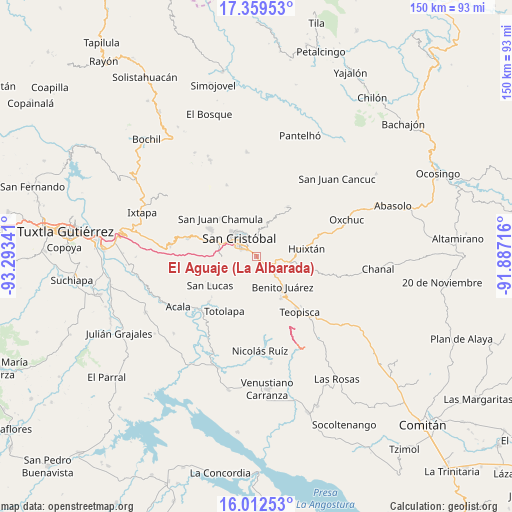
| Upper-left | 17.35953°, | -93.29341° |
| Center: | 16.68722°, | -92.59028° |
| Lower-right: | 16.01253°, | -91.88716° |
| Map W x H: | 149.8×149.8 km | = 93.1×93.1mi |
| max Lat: | 32.7° ⇑92.9% North |
| El Aguaje (La Albarada): | 16.68722° |
| min Lat: | ⇓7.1% South 14.53588° |
| min Long | El Aguaje (La A | max Long |
| -117.105° | -92.59028° | -86.73105° |
| W 91.2%⇐ | ⇒8.8% E |
Elevation
Elevation of El Aguaje (La Albarada) is 2318 m = 7605 ft, and this is 1064.3 m = 3492 ft above average elevation for this country.
| Max E: |
3497 m = 11473 ft | 12.7% |
| El Aguaje (La Albarada) | 2318 m 7605 ft | |
| Avg. | 1253.7 m = 4113 ft | |
Min E: |
-1 m = -3 ft | 87.3% |
See also: Mexico elevation on elevation.city.
Geographical zone
El Aguaje (La Albarada) is located in North Torrid zone (between Equator and Tropic of Cancer). Distance of this Northern Tropic circle is 750.5 km =466.3 mi to North.| Distance of | km | miles | from El Aguaje (La Albarada) |
|---|---|---|---|
| North Pole | 8151.6 | 5065.2 | to North |
| Arctic Circle | 5545.7 | 3445.9 | to North |
| Tropic Cancer | 750.5 | 466.3 | to North |
| Equator | 1855.4 | 1152.9 | to South |


Nearby cities:
15 places around El Aguaje (La Albarada): (largest is in red/bold)
• Agua de Pajarito
6 km =3.7 mi,  24°
24°
• Corazón de María
6.1 km =3.8 mi,  77°
77°
• Cruztón
8.4 km =5.2 mi,  8°
8°
• El Escalón
8 km =5 mi,  74°
74°
• El Pinar
8.1 km =5 mi,  348°
348°
• La Candelaria
9.6 km =6 mi,  49°
49°
• La Sierra
5.8 km =3.6 mi,  60°
60°
• La Soledad
7.6 km =4.7 mi,  99°
99°
• Lázaro Cárdenas (Chilil)
10.8 km =6.7 mi, 96°
• Mitzitón
6.8 km =4.2 mi,  132°
132°
• Molino los Arcos
6.8 km =4.2 mi,  342°
342°
• Romerillo
9 km =5.6 mi, 15°
• San Antonio del Monte
10.5 km =6.5 mi,  320°
320°
• San Cristóbal de las Casas
7.3 km =4.5 mi,  312°
312°
• San Pedro la Tejería
9.7 km =6 mi, 61°
Sources, notices
• [Note1] Compared only with cities in Mexico existing in our database
• [Src1] Map data: © OpenStreetMap contributors (CC-BY-SA)
• [Src2] Other city data from geonames.org with taken over terms of usage.
• [Src3] Geographical zone / Annual Mean Temperature by Robert A. Rohde @ Wikipedia
