Yamrat geodata
Yamrat (Bauchi) is a populated place; located in Nigeria in Africa/Lagos (GMT+1) time zone. With population of 7,098 people, there are 413 cities with bigger population in this country. Compared to other cities in Nigeria, 65.1% of cities are located further ↓South; 83.2% of cities are located further ←West and 89.7% of cities have lower elevation than Yamrat. Note1


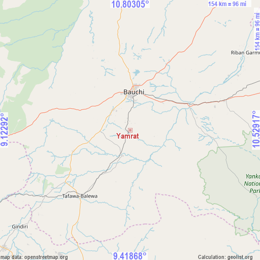
Yamrat GPS coordinates[2]
10° 6' 41.796" North, 9° 49' 33.744" East
| Map corner | latitude | longitude |
|---|---|---|
| Upper-left | 10.80305°, | 9.12292° |
| Center: | 10.11161°, | 9.82604° |
| Lower-right: | 9.41868°, | 10.52917° |
| Map W x H: | 153.9×153.9 km | = 95.6×95.6mi |
| max Lat: | 13.7543° ⇑34.9% North |
| Yamrat: | 10.11161° |
| min Lat: | ⇓65.1% South 4.31231° |
| min Long | Yamrat | max Long |
| 2.73333° | 9.82604° | 14.46552° |
| W 83.2%⇐ | ⇒16.8% E |
Elevation
Elevation of Yamrat is 553 m = 1814 ft, and this is 256.5 m = 842 ft above average elevation for this country.
| Max E: |
1599 m = 5246 ft | 10.3% |
| Yamrat | 553 m 1814 ft | |
| Avg. | 296.5 m = 973 ft | |
Min E: |
2 m = 7 ft | 89.7% |
See also: Nigeria elevation on elevation.city.
Geographical zone
Yamrat is located in North Torrid zone (between Equator and Tropic of Cancer). Distance of Equator is 1124.3 km =698.6 mi to South.| Distance of | km | miles | from Yamrat |
|---|---|---|---|
| North Pole | 8882.8 | 5519.5 | to North |
| Arctic Circle | 6276.9 | 3900.3 | to North |
| Tropic Cancer | 1481.6 | 920.6 | to North |
| Equator | 1124.3 | 698.6 | to South |


Nearby cities:
15 places around Yamrat: (largest is in red/bold)
• Alkaleri
58 km =36 mi,  72°
72°
• Bauchi
22.2 km =13.8 mi,  5°
5°
• Bogoro
54.8 km =34.1 mi,  206°
206°
• Boi
70.8 km =44 mi, 210°
• Bununu
30.1 km =18.7 mi, 211°
• Dass
36.1 km =22.4 mi,  250°
250°
• Dindima
37.8 km =23.5 mi, 70°
• Gwaram
52.1 km =32.4 mi, 74°
• Kafin Madaki
64.5 km =40.1 mi,  353°
353°
• Kirfi
71.2 km =44.2 mi,  62°
62°
• Lame
73.9 km =45.9 mi,  299°
299°
• Lere
69.4 km =43.1 mi,  230°
230°
• Tafawa Balewa
49.3 km =30.6 mi,  217°
217°
• Yuli
67.3 km =41.8 mi,  133°
133°
• Zalanga
67.8 km =42.1 mi,  34°
34°
Sources, notices
• [Note1] Compared only with cities in Nigeria existing in our database
• [Src1] Map data: © OpenStreetMap contributors (CC-BY-SA)
• [Src2] Other city data from geonames.org with taken over terms of usage.
• [Src3] Geographical zone / Annual Mean Temperature by Robert A. Rohde @ Wikipedia
