Lere geodata
Lere (Bauchi) is a populated place; located in Nigeria in Africa/Lagos (GMT+1) time zone. With population of 14,620 people, there are 247 cities with bigger population in this country. Compared to other cities in Nigeria, 61.4% of cities are located further ↓South; 79.6% of cities are located further ←West and 98.3% of cities have lower elevation than Lere. Note1


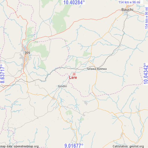
Lere GPS coordinates[2]
9° 42' 37.872" North, 9° 20' 25.044" East
| Map corner | latitude | longitude |
|---|---|---|
| Upper-left | 10.40284°, | 8.63717° |
| Center: | 9.71052°, | 9.34029° |
| Lower-right: | 9.01677°, | 10.04342° |
| Map W x H: | 154.1×154.1 km | = 95.8×95.8mi |
| max Lat: | 13.7543° ⇑38.6% North |
| Lere: | 9.71052° |
| min Lat: | ⇓61.4% South 4.31231° |
| min Long | Lere | max Long |
| 2.73333° | 9.34029° | 14.46552° |
| W 79.6%⇐ | ⇒20.4% E |
Elevation
Elevation of Lere is 873 m = 2864 ft, and this is 576.5 m = 1891 ft above average elevation for this country.
| Max E: |
1599 m = 5246 ft | 1.7% |
| Lere | 873 m 2864 ft | |
| Avg. | 296.5 m = 973 ft | |
Min E: |
2 m = 7 ft | 98.3% |
See also: Nigeria elevation on elevation.city.
Geographical zone
Lere is located in North Torrid zone (between Equator and Tropic of Cancer). Distance of Equator is 1079.7 km =670.9 mi to South.| Distance of | km | miles | from Lere |
|---|---|---|---|
| North Pole | 8927.4 | 5547.2 | to North |
| Arctic Circle | 6321.5 | 3928 | to North |
| Tropic Cancer | 1526.2 | 948.3 | to North |
| Equator | 1079.7 | 670.9 | to South |


Nearby cities:
15 places around Lere: (largest is in red/bold)
• Amper
55.9 km =34.7 mi,  134°
134°
• Angware
40.2 km =25 mi,  320°
320°
• Barkin Ladi
52.7 km =32.7 mi,  248°
248°
• Bogoro
29.4 km =18.3 mi,  99°
99°
• Boi
24.3 km =15.1 mi, 133°
• Bukuru
53 km =32.9 mi,  280°
280°
• Bununu
41.9 km =26 mi,  62°
62°
• Dass
37.6 km =23.4 mi,  30°
30°
• Jos
54.8 km =34.1 mi,  296°
296°
• Kwal
48.6 km =30.2 mi,  140°
140°
• Mangu
34 km =21.1 mi,  231°
231°
• Pankshin
44.1 km =27.4 mi,  166°
166°
• Panyam
36.4 km =22.6 mi,  202°
202°
• Tafawa Balewa
23.8 km =14.8 mi,  76°
76°
• Toro
48.8 km =30.3 mi, 322°
Sources, notices
• [Note1] Compared only with cities in Nigeria existing in our database
• [Src1] Map data: © OpenStreetMap contributors (CC-BY-SA)
• [Src2] Other city data from geonames.org with taken over terms of usage.
• [Src3] Geographical zone / Annual Mean Temperature by Robert A. Rohde @ Wikipedia
