Sabuwa geodata
Sabuwa (Katsina) is a seat of a second-order administrative division; located in Nigeria in Africa/Lagos (GMT+1) time zone. In our database, there are 451 cities with bigger population. Compared to other cities in Nigeria, 73.7% of cities are located further ↓South; 53.6% of cities are located further →East and 95.9% of cities have lower elevation than Sabuwa. Note1


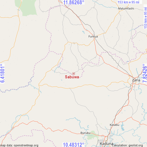
Sabuwa GPS coordinates[2]
11° 10' 25.392" North, 7° 7' 16.068" East
| Map corner | latitude | longitude |
|---|---|---|
| Upper-left | 11.86268°, | 6.41801° |
| Center: | 11.17372°, | 7.12113° |
| Lower-right: | 10.48312°, | 7.82426° |
| Map W x H: | 153.4×153.4 km | = 95.3×95.3mi |
| max Lat: | 13.7543° ⇑26.3% North |
| Sabuwa: | 11.17372° |
| min Lat: | ⇓73.7% South 4.31231° |
| min Long | Sabuwa | max Long |
| 2.73333° | 7.12113° | 14.46552° |
| W 46.4%⇐ | ⇒53.6% E |
Elevation
Elevation of Sabuwa is 680 m = 2231 ft, and this is 383.5 m = 1258 ft above average elevation for this country.
| Max E: |
1599 m = 5246 ft | 4.1% |
| Sabuwa | 680 m 2231 ft | |
| Avg. | 296.5 m = 973 ft | |
Min E: |
2 m = 7 ft | 95.9% |
See also: Nigeria elevation on elevation.city.
Geographical zone
Sabuwa is located in North Torrid zone (between Equator and Tropic of Cancer). Distance of Equator is 1242.4 km =772 mi to South.| Distance of | km | miles | from Sabuwa |
|---|---|---|---|
| North Pole | 8764.7 | 5446.1 | to North |
| Arctic Circle | 6158.8 | 3826.9 | to North |
| Tropic Cancer | 1363.5 | 847.2 | to North |
| Equator | 1242.4 | 772 | to South |


Nearby cities:
15 places around Sabuwa: (largest is in red/bold)
• Bakori
53.8 km =33.4 mi,  37°
37°
• Dan Sadau
69.6 km =43.2 mi,  281°
281°
• Dandume
31.7 km =19.7 mi,  0°
0°
• Danja
53 km =32.9 mi,  64°
64°
• Faskari
61.7 km =38.3 mi,  350°
350°
• Funtua
44.1 km =27.4 mi,  28°
28°
• Giwa
39.1 km =24.3 mi,  66°
66°
• Hunkuyi
58.5 km =36.4 mi,  79°
79°
• Igabi
76.6 km =47.6 mi,  122°
122°
• Kaduna
79.9 km =49.6 mi,  154°
154°
• Kafur
81.3 km =50.5 mi,  49°
49°
• Mando
79 km =49.1 mi,  229°
229°
• Sauri
71.6 km =44.5 mi,  329°
329°
• Sofo-Birnin-Gwari
41.1 km =25.5 mi,  244°
244°
• Zaria
66 km =41 mi,  96°
96°
Sources, notices
• [Note1] Compared only with cities in Nigeria existing in our database
• [Src1] Map data: © OpenStreetMap contributors (CC-BY-SA)
• [Src2] Other city data from geonames.org with taken over terms of usage.
• [Src3] Geographical zone / Annual Mean Temperature by Robert A. Rohde @ Wikipedia
