Obiaruku geodata
Obiaruku (Delta) is a seat of a second-order administrative division; located in Nigeria in Africa/Lagos (GMT+1) time zone. With population of 11,936 people, there are 297 cities with bigger population in this country. Compared to other cities in Nigeria, 85.7% of cities are located further ↑North; 68.7% of cities are located further →East and 89.3% of cities have higher elevation than Obiaruku. Note1


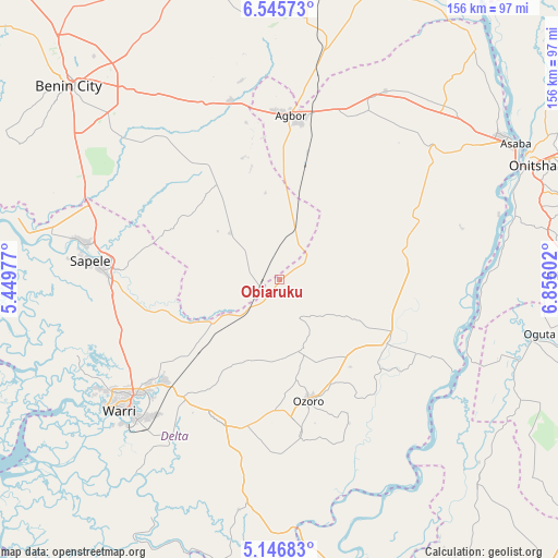
Obiaruku GPS coordinates[2]
5° 50' 48.192" North, 6° 9' 10.44" East
| Map corner | latitude | longitude |
|---|---|---|
| Upper-left | 6.54573°, | 5.44977° |
| Center: | 5.84672°, | 6.1529° |
| Lower-right: | 5.14683°, | 6.85602° |
| Map W x H: | 155.5×155.5 km | = 96.6×96.6mi |
| max Lat: | 13.7543° ⇑85.7% North |
| Obiaruku: | 5.84672° |
| min Lat: | ⇓14.3% South 4.31231° |
| min Long | Obiaruku | max Long |
| 2.73333° | 6.1529° | 14.46552° |
| W 31.3%⇐ | ⇒68.7% E |
Elevation
Elevation of Obiaruku is 35 m = 115 ft, and this is 261.5 m = 858 ft below average elevation for this country.
| Max E: |
1599 m = 5246 ft | 89.3% |
| Avg. | 296.5 m = 973 ft | |
| Obiaruku | 35 m = 115 ft | |
Min E: |
2 m = 7 ft | 10.7% |
See also: Nigeria elevation on elevation.city.
Geographical zone
Obiaruku is located in North Torrid zone (between Equator and Tropic of Cancer). Distance of Equator is 650.1 km =404 mi to South.| Distance of | km | miles | from Obiaruku |
|---|---|---|---|
| North Pole | 9357 | 5814.2 | to North |
| Arctic Circle | 6751.1 | 4194.9 | to North |
| Tropic Cancer | 1955.8 | 1215.3 | to North |
| Equator | 650.1 | 404 | to South |


Nearby cities:
15 places around Obiaruku: (largest is in red/bold)
• Aboh
53 km =32.9 mi,  128°
128°
• Abraka
8.2 km =5.1 mi,  220°
220°
• Abudu
51.7 km =32.1 mi,  344°
344°
• Agbor
45.5 km =28.3 mi,  5°
5°
• Effurun
52 km =32.3 mi,  231°
231°
• Isiokolo
32.6 km =20.3 mi,  211°
211°
• Kwale
34.7 km =21.6 mi,  116°
116°
• Oleh
43.2 km =26.8 mi,  172°
172°
• Orerokpe
37.2 km =23.1 mi, 231°
• Otor-Udu
53.8 km =33.4 mi, 215°
• Owa-Oyibu
37.7 km =23.4 mi, 7°
• Ozoro
34.3 km =21.3 mi, 166°
• Sapele
52.9 km =32.9 mi,  275°
275°
• Ughelli
43 km =26.7 mi,  202°
202°
• Umunede
49.7 km =30.9 mi,  20°
20°
Sources, notices
• [Note1] Compared only with cities in Nigeria existing in our database
• [Src1] Map data: © OpenStreetMap contributors (CC-BY-SA)
• [Src2] Other city data from geonames.org with taken over terms of usage.
• [Src3] Geographical zone / Annual Mean Temperature by Robert A. Rohde @ Wikipedia
