Nasarawa Egon geodata
Nasarawa Egon (Nassarawa) is a seat of a second-order administrative division; located in Nigeria in Africa/Lagos (GMT+1) time zone. In our database, there are 451 cities with bigger population. Compared to other cities in Nigeria, 52.3% of cities are located further ↓South; 72.4% of cities are located further ←West and 51.7% of cities have higher elevation than Nasarawa Egon. Note1


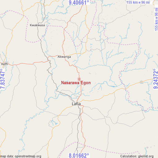
Nasarawa Egon GPS coordinates[2]
8° 42' 44.136" North, 8° 32' 26.16" East
| Map corner | latitude | longitude |
|---|---|---|
| Upper-left | 9.40661°, | 7.83747° |
| Center: | 8.71226°, | 8.5406° |
| Lower-right: | 8.01662°, | 9.24372° |
| Map W x H: | 154.6×154.6 km | = 96.1×96.1mi |
| max Lat: | 13.7543° ⇑47.7% North |
| Nasarawa Egon: | 8.71226° |
| min Lat: | ⇓52.3% South 4.31231° |
| min Long | Nasarawa Egon | max Long |
| 2.73333° | 8.5406° | 14.46552° |
| W 72.4%⇐ | ⇒27.6% E |
Elevation
Elevation of Nasarawa Egon is 272 m = 892 ft, and this is 24.5 m = 80 ft below average elevation for this country.
| Max E: |
1599 m = 5246 ft | 51.7% |
| Avg. | 296.5 m = 973 ft | |
| Nasarawa Egon | 272 m = 892 ft | |
Min E: |
2 m = 7 ft | 48.3% |
See also: Nigeria elevation on elevation.city.
Geographical zone
Nasarawa Egon is located in North Torrid zone (between Equator and Tropic of Cancer). Distance of Equator is 968.7 km =601.9 mi to South.| Distance of | km | miles | from Nasarawa Egon |
|---|---|---|---|
| North Pole | 9038.3 | 5616.1 | to North |
| Arctic Circle | 6432.5 | 3997 | to North |
| Tropic Cancer | 1637.2 | 1017.3 | to North |
| Equator | 968.7 | 601.9 | to South |


Nearby cities:
15 places around Nasarawa Egon: (largest is in red/bold)
• Akwanga
26.5 km =16.5 mi,  326°
326°
• Awe
94.4 km =58.7 mi,  135°
135°
• Baap
81.2 km =50.5 mi,  71°
71°
• Barkin Ladi
99.6 km =61.9 mi,  22°
22°
• Bokkos
82.1 km =51 mi,  37°
37°
• Doma
40.9 km =25.4 mi,  209°
209°
• Garaku
47.5 km =29.5 mi,  288°
288°
• Gwantu
58.2 km =36.2 mi,  351°
351°
• Keana
68.8 km =42.8 mi,  155°
155°
• Keffi
74.8 km =46.5 mi,  281°
281°
• Kwolla
85.1 km =52.9 mi,  75°
75°
• Lafia
24.4 km =15.2 mi,  186°
186°
• Nasarawa
93.5 km =58.1 mi,  258°
258°
• Obi
46 km =28.6 mi,  146°
146°
• Wamba
26.4 km =16.4 mi, 15°
Sources, notices
• [Note1] Compared only with cities in Nigeria existing in our database
• [Src1] Map data: © OpenStreetMap contributors (CC-BY-SA)
• [Src2] Other city data from geonames.org with taken over terms of usage.
• [Src3] Geographical zone / Annual Mean Temperature by Robert A. Rohde @ Wikipedia
