Wamba geodata
Wamba (Nassarawa) is a seat of a second-order administrative division; located in Nigeria in Africa/Lagos (GMT+1) time zone. With population of 27,137 people, there are 167 cities with bigger population in this country. Compared to other cities in Nigeria, 54.4% of cities are located further ↓South; 72.9% of cities are located further ←West and 68.4% of cities have lower elevation than Wamba. Note1


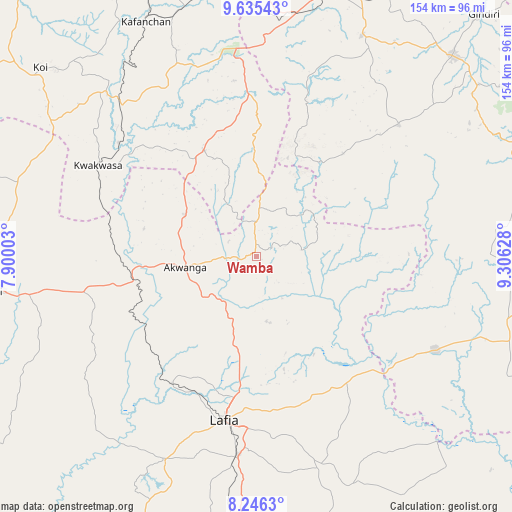
Wamba GPS coordinates[2]
8° 56' 29.508" North, 8° 36' 11.34" East
| Map corner | latitude | longitude |
|---|---|---|
| Upper-left | 9.63543°, | 7.90003° |
| Center: | 8.94153°, | 8.60315° |
| Lower-right: | 8.2463°, | 9.30628° |
| Map W x H: | 154.5×154.5 km | = 96×96mi |
| max Lat: | 13.7543° ⇑45.6% North |
| Wamba: | 8.94153° |
| min Lat: | ⇓54.4% South 4.31231° |
| min Long | Wamba | max Long |
| 2.73333° | 8.60315° | 14.46552° |
| W 72.9%⇐ | ⇒27.1% E |
Elevation
Elevation of Wamba is 388 m = 1273 ft, and this is 91.5 m = 300 ft above average elevation for this country.
| Max E: |
1599 m = 5246 ft | 31.6% |
| Wamba | 388 m 1273 ft | |
| Avg. | 296.5 m = 973 ft | |
Min E: |
2 m = 7 ft | 68.4% |
See also: Nigeria elevation on elevation.city.
Geographical zone
Wamba is located in North Torrid zone (between Equator and Tropic of Cancer). Distance of Equator is 994.2 km =617.8 mi to South.| Distance of | km | miles | from Wamba |
|---|---|---|---|
| North Pole | 9012.9 | 5600.4 | to North |
| Arctic Circle | 6407 | 3981.1 | to North |
| Tropic Cancer | 1611.7 | 1001.5 | to North |
| Equator | 994.2 | 617.8 | to South |


Nearby cities:
15 places around Wamba: (largest is in red/bold)
• Akwanga
21.9 km =13.6 mi,  261°
261°
• Baap
70.1 km =43.6 mi,  89°
89°
• Barkin Ladi
73.6 km =45.7 mi,  25°
25°
• Bokkos
58.6 km =36.4 mi,  47°
47°
• Doma
66.8 km =41.5 mi,  204°
204°
• Garaku
53 km =32.9 mi, 258°
• Gwantu
35.7 km =22.2 mi,  333°
333°
• Kafanchan
78.9 km =49 mi, 334°
• Kagoro
77.7 km =48.3 mi,  342°
342°
• Keffi
80.8 km =50.2 mi, 262°
• Kwolla
75.7 km =47 mi, 93°
• Lafia
50.7 km =31.5 mi,  190°
190°
• Nasarawa Egon
26.4 km =16.4 mi, 195°
• Obi
66.3 km =41.2 mi,  163°
163°
• Riyom
79.1 km =49.2 mi,  12°
12°
Sources, notices
• [Note1] Compared only with cities in Nigeria existing in our database
• [Src1] Map data: © OpenStreetMap contributors (CC-BY-SA)
• [Src2] Other city data from geonames.org with taken over terms of usage.
• [Src3] Geographical zone / Annual Mean Temperature by Robert A. Rohde @ Wikipedia
