Madagali geodata
Madagali (Adamawa) is a populated place; located in Nigeria in Africa/Lagos (GMT+1) time zone. With population of 12,919 people, there are 275 cities with bigger population in this country. Compared to other cities in Nigeria, 72% of cities are located further ↓South; 99.2% of cities are located further ←West and 85% of cities have lower elevation than Madagali. Note1


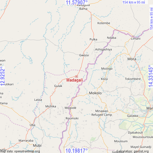
Madagali GPS coordinates[2]
10° 53' 21.912" North, 13° 37' 41.952" East
| Map corner | latitude | longitude |
|---|---|---|
| Upper-left | 11.57907°, | 12.9252° |
| Center: | 10.88942°, | 13.62832° |
| Lower-right: | 10.19817°, | 14.33145° |
| Map W x H: | 153.5×153.5 km | = 95.4×95.4mi |
| max Lat: | 13.7543° ⇑28% North |
| Madagali: | 10.88942° |
| min Lat: | ⇓72% South 4.31231° |
| min Long | Madagali | max Long |
| 2.73333° | 13.62832° | 14.46552° |
| W 99.2%⇐ | ⇒0.8% E |
Elevation
Elevation of Madagali is 503 m = 1650 ft, and this is 206.5 m = 677 ft above average elevation for this country.
| Max E: |
1599 m = 5246 ft | 15% |
| Madagali | 503 m 1650 ft | |
| Avg. | 296.5 m = 973 ft | |
Min E: |
2 m = 7 ft | 85% |
See also: Nigeria elevation on elevation.city.
Geographical zone
Madagali is located in North Torrid zone (between Equator and Tropic of Cancer). Distance of Equator is 1210.8 km =752.4 mi to South.| Distance of | km | miles | from Madagali |
|---|---|---|---|
| North Pole | 8796.3 | 5465.8 | to North |
| Arctic Circle | 6190.4 | 3846.5 | to North |
| Tropic Cancer | 1395.1 | 866.9 | to North |
| Equator | 1210.8 | 752.4 | to South |


Nearby cities:
15 places around Madagali: (largest is in red/bold)
• Askira
82.9 km =51.5 mi,  251°
251°
• Bama
70.6 km =43.9 mi,  5°
5°
• Chibok
85.4 km =53.1 mi,  268°
268°
• Damboa
99.6 km =61.9 mi,  287°
287°
• Gella
89 km =55.3 mi,  203°
203°
• Gulak
20.8 km =12.9 mi,  243°
243°
• Gwoza
22.8 km =14.2 mi,  18°
18°
• Hong
105.8 km =65.7 mi,  226°
226°
• Konduga
88 km =54.7 mi,  344°
344°
• Maiha
109 km =67.7 mi, 204°
• Michika
39.7 km =24.7 mi,  221°
221°
• Mubi
79.5 km =49.4 mi,  209°
209°
• Tokombere
40 km =24.9 mi, 337°
• Uba
65.6 km =40.8 mi, 222°
• Yajiwa
113.5 km =70.5 mi,  299°
299°
Sources, notices
• [Note1] Compared only with cities in Nigeria existing in our database
• [Src1] Map data: © OpenStreetMap contributors (CC-BY-SA)
• [Src2] Other city data from geonames.org with taken over terms of usage.
• [Src3] Geographical zone / Annual Mean Temperature by Robert A. Rohde @ Wikipedia
