Jos geodata
Jos (Plateau) is a seat of a first-order administrative division; located in Nigeria in Africa/Lagos (GMT+1) time zone. With population of 816,824 people, there are 9 cities with bigger population in this country. Compared to other cities in Nigeria, 63.8% of cities are located further ↓South; 75.8% of cities are located further ←West and 99.2% of cities have lower elevation than Jos. Note1


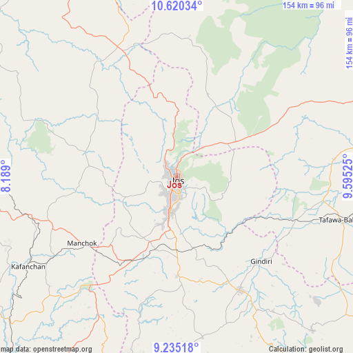
Jos GPS coordinates[2]
9° 55' 42.564" North, 8° 53' 31.632" East
| Map corner | latitude | longitude |
|---|---|---|
| Upper-left | 10.62034°, | 8.189° |
| Center: | 9.92849°, | 8.89212° |
| Lower-right: | 9.23518°, | 9.59525° |
| Map W x H: | 154×154 km | = 95.7×95.7mi |
| max Lat: | 13.7543° ⇑36.2% North |
| Jos: | 9.92849° |
| min Lat: | ⇓63.8% South 4.31231° |
| min Long | Jos | max Long |
| 2.73333° | 8.89212° | 14.46552° |
| W 75.8%⇐ | ⇒24.2% E |
Elevation
Elevation of Jos is 1186 m = 3891 ft, and this is 889.5 m = 2918 ft above average elevation for this country.
| Max E: |
1599 m = 5246 ft | 0.8% |
| Jos | 1186 m 3891 ft | |
| Avg. | 296.5 m = 973 ft | |
Min E: |
2 m = 7 ft | 99.2% |
See also: Jos elevation on elevation.city.
Geographical zone
Jos is located in North Torrid zone (between Equator and Tropic of Cancer). Distance of Equator is 1103.9 km =685.9 mi to South.| Distance of | km | miles | from Jos |
|---|---|---|---|
| North Pole | 8903.1 | 5532.1 | to North |
| Arctic Circle | 6297.2 | 3912.9 | to North |
| Tropic Cancer | 1502 | 933.3 | to North |
| Equator | 1103.9 | 685.9 | to South |


Nearby cities:
15 places around Jos: (largest is in red/bold)
• Angware
24.7 km =15.3 mi,  73°
73°
• Barkin Ladi
43.4 km =27 mi,  179°
179°
• Bassa
16.7 km =10.4 mi,  275°
275°
• Bukuru
15.3 km =9.5 mi,  191°
191°
• Kagoro
65.5 km =40.7 mi,  237°
237°
• Kaura
55.7 km =34.6 mi, 238°
• Lere
54.8 km =34.1 mi,  116°
116°
• Lere
61.7 km =38.3 mi,  325°
325°
• Mangu
50.6 km =31.4 mi,  153°
153°
• Panyam
67.9 km =42.2 mi, 148°
• Riyom
35.7 km =22.2 mi,  204°
204°
• Saminaka
58.3 km =36.2 mi,  337°
337°
• Toro
24.2 km =15 mi,  53°
53°
• Vom
24.8 km =15.4 mi,  206°
206°
• Zonkwa
67.8 km =42.1 mi,  256°
256°
Sources, notices
• [Note1] Compared only with cities in Nigeria existing in our database
• [Src1] Map data: © OpenStreetMap contributors (CC-BY-SA)
• [Src2] Other city data from geonames.org with taken over terms of usage.
• [Src3] Geographical zone / Annual Mean Temperature by Robert A. Rohde @ Wikipedia
