Bukuru geodata
Bukuru (Plateau) is a seat of a second-order administrative division; located in Nigeria in Africa/Lagos (GMT+1) time zone. With population of 15,540 people, there are 235 cities with bigger population in this country. Compared to other cities in Nigeria, 62.2% of cities are located further ↓South; 75.5% of cities are located further ←West and 99.7% of cities have lower elevation than Bukuru. Note1


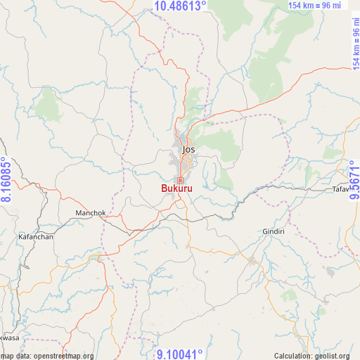
Bukuru GPS coordinates[2]
9° 47' 38.364" North, 8° 51' 50.292" East
| Map corner | latitude | longitude |
|---|---|---|
| Upper-left | 10.48613°, | 8.16085° |
| Center: | 9.79399°, | 8.86397° |
| Lower-right: | 9.10041°, | 9.5671° |
| Map W x H: | 154.1×154.1 km | = 95.8×95.8mi |
| max Lat: | 13.7543° ⇑37.8% North |
| Bukuru: | 9.79399° |
| min Lat: | ⇓62.2% South 4.31231° |
| min Long | Bukuru | max Long |
| 2.73333° | 8.86397° | 14.46552° |
| W 75.5%⇐ | ⇒24.5% E |
Elevation
Elevation of Bukuru is 1277 m = 4190 ft, and this is 980.5 m = 3217 ft above average elevation for this country.
| Max E: |
1599 m = 5246 ft | 0.3% |
| Bukuru | 1277 m 4190 ft | |
| Avg. | 296.5 m = 973 ft | |
Min E: |
2 m = 7 ft | 99.7% |
See also: Nigeria elevation on elevation.city.
Geographical zone
Bukuru is located in North Torrid zone (between Equator and Tropic of Cancer). Distance of Equator is 1089 km =676.7 mi to South.| Distance of | km | miles | from Bukuru |
|---|---|---|---|
| North Pole | 8918.1 | 5541.4 | to North |
| Arctic Circle | 6312.2 | 3922.2 | to North |
| Tropic Cancer | 1516.9 | 942.6 | to North |
| Equator | 1089 | 676.7 | to South |


Nearby cities:
15 places around Bukuru: (largest is in red/bold)
• Angware
34.6 km =21.5 mi,  50°
50°
• Barkin Ladi
28.6 km =17.8 mi,  173°
173°
• Bassa
21.3 km =13.2 mi,  320°
320°
• Bokkos
56.9 km =35.4 mi, 165°
• Jos
15.3 km =9.5 mi,  11°
11°
• Kafanchan
66.9 km =41.6 mi,  249°
249°
• Kagoro
55.9 km =34.7 mi, 248°
• Kaura
46.6 km =29 mi, 252°
• Lere
53 km =32.9 mi,  100°
100°
• Mangu
39.8 km =24.7 mi,  139°
139°
• Panyam
57.7 km =35.9 mi, 138°
• Riyom
21 km =13 mi,  213°
213°
• Toro
37 km =23 mi,  37°
37°
• Vom
10.7 km =6.6 mi,  227°
227°
• Zonkwa
62.8 km =39 mi,  269°
269°
Sources, notices
• [Note1] Compared only with cities in Nigeria existing in our database
• [Src1] Map data: © OpenStreetMap contributors (CC-BY-SA)
• [Src2] Other city data from geonames.org with taken over terms of usage.
• [Src3] Geographical zone / Annual Mean Temperature by Robert A. Rohde @ Wikipedia
