Jibia geodata
Jibia (Katsina) is a seat of a second-order administrative division; located in Nigeria in Africa/Lagos (GMT+1) time zone. With population of 14,424 people, there are 251 cities with bigger population in this country. Compared to other cities in Nigeria, 97.9% of cities are located further ↓South; 52.2% of cities are located further →East and 71.5% of cities have lower elevation than Jibia. Note1


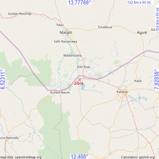
Jibia GPS coordinates[2]
13° 5' 37.608" North, 7° 13' 34.464" East
| Map corner | latitude | longitude |
|---|---|---|
| Upper-left | 13.77766°, | 6.52311° |
| Center: | 13.09378°, | 7.22624° |
| Lower-right: | 12.408°, | 7.92936° |
| Map W x H: | 152.3×152.3 km | = 94.6×94.6mi |
| max Lat: | 13.7543° ⇑2.1% North |
| Jibia: | 13.09378° |
| min Lat: | ⇓97.9% South 4.31231° |
| min Long | Jibia | max Long |
| 2.73333° | 7.22624° | 14.46552° |
| W 47.8%⇐ | ⇒52.2% E |
Elevation
Elevation of Jibia is 409 m = 1342 ft, and this is 112.5 m = 369 ft above average elevation for this country.
| Max E: |
1599 m = 5246 ft | 28.5% |
| Jibia | 409 m 1342 ft | |
| Avg. | 296.5 m = 973 ft | |
Min E: |
2 m = 7 ft | 71.5% |
See also: Nigeria elevation on elevation.city.
Geographical zone
Jibia is located in North Torrid zone (between Equator and Tropic of Cancer). Distance of this Northern Tropic circle is 1150 km =714.6 mi to North.| Distance of | km | miles | from Jibia |
|---|---|---|---|
| North Pole | 8551.2 | 5313.5 | to North |
| Arctic Circle | 5945.3 | 3694.2 | to North |
| Tropic Cancer | 1150 | 714.6 | to North |
| Equator | 1455.9 | 904.7 | to South |


Nearby cities:
15 places around Jibia: (largest is in red/bold)
• Batagarawa
46.1 km =28.6 mi,  116°
116°
• Batsari
37.7 km =23.4 mi,  176°
176°
• Birnin Magaji
69.5 km =43.2 mi,  211°
211°
• Charanchi
72 km =44.7 mi,  130°
130°
• Dankama
65.6 km =40.8 mi,  69°
69°
• Dutsin-Ma
77 km =47.8 mi,  157°
157°
• Kaita
55.8 km =34.7 mi,  91°
91°
• Katsina
42.3 km =26.3 mi,  105°
105°
• Kurfi
55.2 km =34.3 mi,  149°
149°
• Mani
75.2 km =46.7 mi, 110°
• Rimi
59 km =36.7 mi, 117°
• Ruma
25.7 km =16 mi, 177°
• Runka
72.4 km =45 mi,  172°
172°
• Wagini
45.3 km =28.1 mi, 184°
• Zurmi
59.5 km =37 mi,  233°
233°
Sources, notices
• [Note1] Compared only with cities in Nigeria existing in our database
• [Src1] Map data: © OpenStreetMap contributors (CC-BY-SA)
• [Src2] Other city data from geonames.org with taken over terms of usage.
• [Src3] Geographical zone / Annual Mean Temperature by Robert A. Rohde @ Wikipedia
