Dutsin-Ma geodata
Dutsin-Ma (Katsina) is a seat of a second-order administrative division; located in Nigeria in Africa/Lagos (GMT+1) time zone. With population of 12,595 people, there are 285 cities with bigger population in this country. Compared to other cities in Nigeria, 90.2% of cities are located further ↓South; 53.4% of cities are located further ←West and 89.3% of cities have lower elevation than Dutsin-Ma. Note1


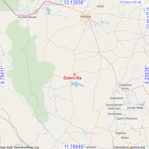
Dutsin-Ma GPS coordinates[2]
12° 27' 14.112" North, 7° 29' 50.028" East
| Map corner | latitude | longitude |
|---|---|---|
| Upper-left | 13.13958°, | 6.79411° |
| Center: | 12.45392°, | 7.49723° |
| Lower-right: | 11.76645°, | 8.20036° |
| Map W x H: | 152.7×152.7 km | = 94.9×94.9mi |
| max Lat: | 13.7543° ⇑9.8% North |
| Dutsin-Ma: | 12.45392° |
| min Lat: | ⇓90.2% South 4.31231° |
| min Long | Dutsin-Ma | max Long |
| 2.73333° | 7.49723° | 14.46552° |
| W 53.4%⇐ | ⇒46.6% E |
Elevation
Elevation of Dutsin-Ma is 544 m = 1785 ft, and this is 247.5 m = 812 ft above average elevation for this country.
| Max E: |
1599 m = 5246 ft | 10.7% |
| Dutsin-Ma | 544 m 1785 ft | |
| Avg. | 296.5 m = 973 ft | |
Min E: |
2 m = 7 ft | 89.3% |
See also: Nigeria elevation on elevation.city.
Geographical zone
Dutsin-Ma is located in North Torrid zone (between Equator and Tropic of Cancer). Distance of this Northern Tropic circle is 1221.2 km =758.8 mi to North.| Distance of | km | miles | from Dutsin-Ma |
|---|---|---|---|
| North Pole | 8622.3 | 5357.6 | to North |
| Arctic Circle | 6016.4 | 3738.4 | to North |
| Tropic Cancer | 1221.2 | 758.8 | to North |
| Equator | 1384.7 | 860.4 | to South |


Nearby cities:
15 places around Dutsin-Ma: (largest is in red/bold)
• Batagarawa
51.6 km =32.1 mi,  13°
13°
• Batsari
43.1 km =26.8 mi,  321°
321°
• Bindawa
41.5 km =25.8 mi,  54°
54°
• Charanchi
34.9 km =21.7 mi, 46°
• Dan Musa
27.8 km =17.3 mi,  219°
219°
• Jikamshi
43.4 km =27 mi,  136°
136°
• Kankia
36.8 km =22.9 mi,  73°
73°
• Kurfi
23.7 km =14.7 mi,  356°
356°
• Kusada
52.3 km =32.5 mi,  88°
88°
• Matazu
31 km =19.3 mi, 141°
• Musawa
40.7 km =25.3 mi,  152°
152°
• Rimi
49.7 km =30.9 mi,  27°
27°
• Runka
20.4 km =12.7 mi,  268°
268°
• Safana
10.2 km =6.3 mi,  241°
241°
• Wagini
41.8 km =26 mi,  308°
308°
Sources, notices
• [Note1] Compared only with cities in Nigeria existing in our database
• [Src1] Map data: © OpenStreetMap contributors (CC-BY-SA)
• [Src2] Other city data from geonames.org with taken over terms of usage.
• [Src3] Geographical zone / Annual Mean Temperature by Robert A. Rohde @ Wikipedia
