Ayetoro geodata
Ayetoro (Ogun) is a seat of a second-order administrative division; located in Nigeria in Africa/Lagos (GMT+1) time zone. In our database, there are 451 cities with bigger population. Compared to other cities in Nigeria, 65.3% of cities are located further ↑North; 99.3% of cities are located further →East and 76.7% of cities have higher elevation than Ayetoro. Note1


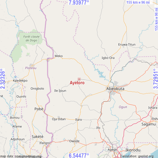
Ayetoro GPS coordinates[2]
7° 14' 34.116" North, 3° 1' 35.004" East
| Map corner | latitude | longitude |
|---|---|---|
| Upper-left | 7.93977°, | 2.32326° |
| Center: | 7.24281°, | 3.02639° |
| Lower-right: | 6.54477°, | 3.72951° |
| Map W x H: | 155.1×155.1 km | = 96.4×96.4mi |
| max Lat: | 13.7543° ⇑65.3% North |
| Ayetoro: | 7.24281° |
| min Lat: | ⇓34.7% South 4.31231° |
| min Long | Ayetoro | max Long |
| 2.73333° | 3.02639° | 14.46552° |
| W 0.7%⇐ | ⇒99.3% E |
Elevation
Elevation of Ayetoro is 105 m = 344 ft, and this is 191.5 m = 628 ft below average elevation for this country.
| Max E: |
1599 m = 5246 ft | 76.7% |
| Avg. | 296.5 m = 973 ft | |
| Ayetoro | 105 m = 344 ft | |
Min E: |
2 m = 7 ft | 23.3% |
See also: Nigeria elevation on elevation.city.
Geographical zone
Ayetoro is located in North Torrid zone (between Equator and Tropic of Cancer). Distance of Equator is 805.3 km =500.4 mi to South.| Distance of | km | miles | from Ayetoro |
|---|---|---|---|
| North Pole | 9201.7 | 5717.7 | to North |
| Arctic Circle | 6595.8 | 4098.4 | to North |
| Tropic Cancer | 1800.6 | 1118.8 | to North |
| Equator | 805.3 | 500.4 | to South |


Nearby cities:
15 places around Ayetoro: (largest is in red/bold)
• Abeokuta
36.5 km =22.7 mi,  105°
105°
• Ado Odo
72.2 km =44.9 mi,  188°
188°
• Ayete
39.8 km =24.7 mi,  32°
32°
• Eruwa
53.9 km =33.5 mi,  53°
53°
• Idi Iroko
75.1 km =46.7 mi,  205°
205°
• Ifako
74.3 km =46.2 mi,  153°
153°
• Ifo
51.1 km =31.8 mi,  158°
158°
• Igbo-Ora
35.8 km =22.2 mi, 53°
• Ilaro
39.4 km =24.5 mi,  181°
181°
• Imeko
30.6 km =19 mi,  318°
318°
• Itori
40.8 km =25.4 mi, 148°
• Odeda
55.4 km =34.4 mi,  91°
91°
• Orita Eruwa
56.4 km =35 mi, 52°
• Ota
65.7 km =40.8 mi, 159°
• Owode
62.2 km =38.6 mi,  121°
121°
Sources, notices
• [Note1] Compared only with cities in Nigeria existing in our database
• [Src1] Map data: © OpenStreetMap contributors (CC-BY-SA)
• [Src2] Other city data from geonames.org with taken over terms of usage.
• [Src3] Geographical zone / Annual Mean Temperature by Robert A. Rohde @ Wikipedia
