Holma geodata
Holma (Adamawa) is a populated place; located in Nigeria in Africa/Lagos (GMT+1) time zone. With population of 9,199 people, there are 351 cities with bigger population in this country. Compared to other cities in Nigeria, 63.4% of cities are located further ↓South; 97.3% of cities are located further ←West and 91.2% of cities have lower elevation than Holma. Note1


Holma GPS coordinates[2]
9° 53' 55.068" North, 13° 3' 16.2" East
| Map corner | latitude | longitude |
|---|---|---|
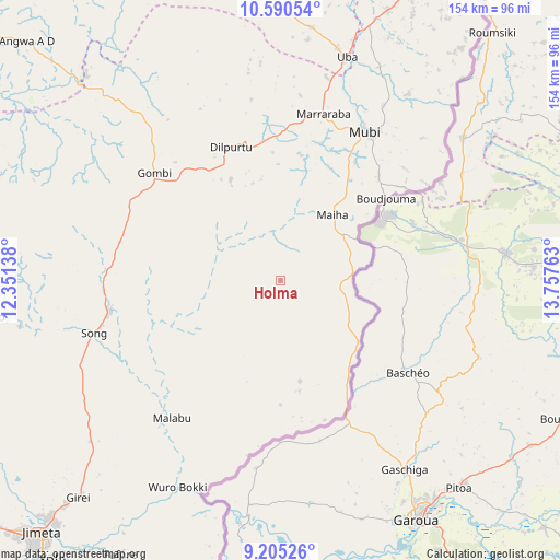
| Upper-left | 10.59054°, | 12.35138° |
| Center: | 9.89863°, | 13.0545° |
| Lower-right: | 9.20526°, | 13.75763° |
| Map W x H: | 154×154 km | = 95.7×95.7mi |
| max Lat: | 13.7543° ⇑36.6% North |
| Holma: | 9.89863° |
| min Lat: | ⇓63.4% South 4.31231° |
| min Long | Holma | max Long |
| 2.73333° | 13.0545° | 14.46552° |
| W 97.3%⇐ | ⇒2.7% E |
Elevation
Elevation of Holma is 570 m = 1870 ft, and this is 273.5 m = 897 ft above average elevation for this country.
| Max E: |
1599 m = 5246 ft | 8.8% |
| Holma | 570 m 1870 ft | |
| Avg. | 296.5 m = 973 ft | |
Min E: |
2 m = 7 ft | 91.2% |
See also: Nigeria elevation on elevation.city.
Geographical zone
Holma is located in North Torrid zone (between Equator and Tropic of Cancer). Distance of Equator is 1100.6 km =683.9 mi to South.| Distance of | km | miles | from Holma |
|---|---|---|---|
| North Pole | 8906.4 | 5534.2 | to North |
| Arctic Circle | 6300.5 | 3914.9 | to North |
| Tropic Cancer | 1505.3 | 935.3 | to North |
| Equator | 1100.6 | 683.9 | to South |


Nearby cities:
15 places around Holma: (largest is in red/bold)
• Askira
85.1 km =52.9 mi,  349°
349°
• Azare
108.8 km =67.6 mi,  309°
309°
• Fufore
87.4 km =54.3 mi,  210°
210°
• Gella
39.4 km =24.5 mi,  43°
43°
• Girei
81.4 km =50.6 mi,  223°
223°
• Gombi
45.9 km =28.5 mi, 310°
• Hong
39.7 km =24.7 mi,  339°
339°
• Jimeta
94.9 km =59 mi, 223°
• Maiha
20.8 km =12.9 mi,  58°
58°
• Michika
88.2 km =54.8 mi,  24°
24°
• Mubi
47.3 km =29.4 mi,  29°
29°
• Shaffa
103.9 km =64.6 mi, 310°
• Song
47.9 km =29.8 mi,  260°
260°
• Uba
64.5 km =40.1 mi, 16°
• Yola
99.2 km =61.6 mi, 219°
Sources, notices
• [Note1] Compared only with cities in Nigeria existing in our database
• [Src1] Map data: © OpenStreetMap contributors (CC-BY-SA)
• [Src2] Other city data from geonames.org with taken over terms of usage.
• [Src3] Geographical zone / Annual Mean Temperature by Robert A. Rohde @ Wikipedia
