Gombe geodata
Gombe is a seat of a first-order administrative division; located in Nigeria in Africa/Lagos (GMT+1) time zone. With population of 250,258 people, there are 36 cities with bigger population in this country. Compared to other cities in Nigeria, 66.7% of cities are located further ↓South; 89.7% of cities are located further ←West and 78.8% of cities have lower elevation than Gombe. Note1


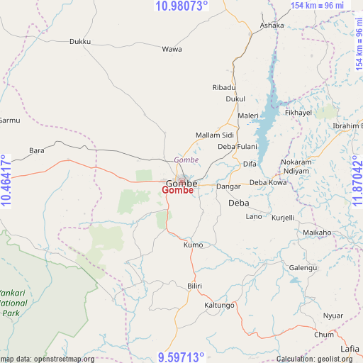
Gombe GPS coordinates[2]
10° 17' 22.884" North, 11° 10' 2.244" East
| Map corner | latitude | longitude |
|---|---|---|
| Upper-left | 10.98073°, | 10.46417° |
| Center: | 10.28969°, | 11.16729° |
| Lower-right: | 9.59713°, | 11.87042° |
| Map W x H: | 153.8×153.8 km | = 95.6×95.6mi |
| max Lat: | 13.7543° ⇑33.3% North |
| Gombe: | 10.28969° |
| min Lat: | ⇓66.7% South 4.31231° |
| min Long | Gombe | max Long |
| 2.73333° | 11.16729° | 14.46552° |
| W 89.7%⇐ | ⇒10.3% E |
Elevation
Elevation of Gombe is 460 m = 1509 ft, and this is 163.5 m = 536 ft above average elevation for this country.
| Max E: |
1599 m = 5246 ft | 21.2% |
| Gombe | 460 m 1509 ft | |
| Avg. | 296.5 m = 973 ft | |
Min E: |
2 m = 7 ft | 78.8% |
See also: Gombe elevation on elevation.city.
Geographical zone
Gombe is located in North Torrid zone (between Equator and Tropic of Cancer). Distance of Equator is 1144.1 km =710.9 mi to South.| Distance of | km | miles | from Gombe |
|---|---|---|---|
| North Pole | 8863 | 5507.2 | to North |
| Arctic Circle | 6257.1 | 3888 | to North |
| Tropic Cancer | 1461.8 | 908.3 | to North |
| Equator | 1144.1 | 710.9 | to South |


Nearby cities:
15 places around Gombe: (largest is in red/bold)
• Akko
21.2 km =13.2 mi,  269°
269°
• Bara
48.9 km =30.4 mi,  281°
281°
• Billiri
44.8 km =27.8 mi,  172°
172°
• Billiri
47.6 km =29.6 mi, 172°
• Boh
57.8 km =35.9 mi, 167°
• Briyel
48.8 km =30.3 mi,  82°
82°
• Deba
25.6 km =15.9 mi,  109°
109°
• Garko
12.7 km =7.9 mi,  181°
181°
• Hinna
36.3 km =22.6 mi,  87°
87°
• Kafarati
13 km =8.1 mi,  322°
322°
• Kaltungo
54.5 km =33.9 mi,  163°
163°
• Kumo
27.3 km =17 mi, 170°
• Mallam Sidi
24.2 km =15 mi,  34°
34°
• Pindiga
41.3 km =25.7 mi,  214°
214°
• Wuyo
58.9 km =36.6 mi, 79°
Sources, notices
• [Note1] Compared only with cities in Nigeria existing in our database
• [Src1] Map data: © OpenStreetMap contributors (CC-BY-SA)
• [Src2] Other city data from geonames.org with taken over terms of usage.
• [Src3] Geographical zone / Annual Mean Temperature by Robert A. Rohde @ Wikipedia
