Bara geodata
Bara (Gombe) is a populated place; located in Nigeria in Africa/Lagos (GMT+1) time zone. With population of 11,673 people, there are 306 cities with bigger population in this country. Compared to other cities in Nigeria, 67.4% of cities are located further ↓South; 88.1% of cities are located further ←West and 57.7% of cities have lower elevation than Bara. Note1


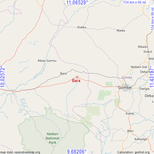
Bara GPS coordinates[2]
10° 22' 27.984" North, 10° 43' 43.824" East
| Map corner | latitude | longitude |
|---|---|---|
| Upper-left | 11.06529°, | 10.02572° |
| Center: | 10.37444°, | 10.72884° |
| Lower-right: | 9.68206°, | 11.43197° |
| Map W x H: | 153.8×153.8 km | = 95.6×95.6mi |
| max Lat: | 13.7543° ⇑32.6% North |
| Bara: | 10.37444° |
| min Lat: | ⇓67.4% South 4.31231° |
| min Long | Bara | max Long |
| 2.73333° | 10.72884° | 14.46552° |
| W 88.1%⇐ | ⇒11.9% E |
Elevation
Elevation of Bara is 330 m = 1083 ft, and this is 33.5 m = 110 ft above average elevation for this country.
| Max E: |
1599 m = 5246 ft | 42.3% |
| Bara | 330 m 1083 ft | |
| Avg. | 296.5 m = 973 ft | |
Min E: |
2 m = 7 ft | 57.7% |
See also: Nigeria elevation on elevation.city.
Geographical zone
Bara is located in North Torrid zone (between Equator and Tropic of Cancer). Distance of Equator is 1153.5 km =716.8 mi to South.| Distance of | km | miles | from Bara |
|---|---|---|---|
| North Pole | 8853.5 | 5501.3 | to North |
| Arctic Circle | 6247.6 | 3882.1 | to North |
| Tropic Cancer | 1452.4 | 902.5 | to North |
| Equator | 1153.5 | 716.8 | to South |


Nearby cities:
15 places around Bara: (largest is in red/bold)
• Akko
28.4 km =17.6 mi,  109°
109°
• Alkaleri
45 km =28 mi,  254°
254°
• Billiri
75.9 km =47.2 mi,  135°
135°
• Deba
74.2 km =46.1 mi,  104°
104°
• Dindima
65.3 km =40.6 mi,  255°
255°
• Dukku
50.2 km =31.2 mi,  5°
5°
• Garko
52.6 km =32.7 mi, 114°
• Gombe
48.9 km =30.4 mi, 101°
• Gwaram
51 km =31.7 mi, 252°
• Kafarati
40.1 km =24.9 mi,  88°
88°
• Kirfi
35.6 km =22.1 mi,  275°
275°
• Kumo
64 km =39.8 mi,  124°
124°
• Mallam Sidi
62.6 km =38.9 mi,  80°
80°
• Pindiga
49.8 km =30.9 mi,  150°
150°
• Zalanga
66 km =41 mi,  293°
293°
Sources, notices
• [Note1] Compared only with cities in Nigeria existing in our database
• [Src1] Map data: © OpenStreetMap contributors (CC-BY-SA)
• [Src2] Other city data from geonames.org with taken over terms of usage.
• [Src3] Geographical zone / Annual Mean Temperature by Robert A. Rohde @ Wikipedia
