Enugu-Ukwu geodata
Enugu-Ukwu (Anambra) is a populated place; located in Nigeria in Africa/Lagos (GMT+1) time zone. With population of 68,785 people, there are 136 cities with bigger population in this country. Compared to other cities in Nigeria, 81.8% of cities are located further ↑North; 56.8% of cities are located further →East and 58.6% of cities have higher elevation than Enugu-Ukwu. Note1


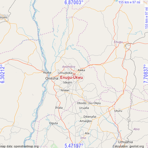
Enugu-Ukwu GPS coordinates[2]
6° 10' 17.256" North, 7° 0' 18.9" East
| Map corner | latitude | longitude |
|---|---|---|
| Upper-left | 6.87003°, | 6.30212° |
| Center: | 6.17146°, | 7.00525° |
| Lower-right: | 5.47197°, | 7.70837° |
| Map W x H: | 155.4×155.5 km | = 96.6×96.6mi |
| max Lat: | 13.7543° ⇑81.8% North |
| Enugu-Ukwu: | 6.17146° |
| min Lat: | ⇓18.2% South 4.31231° |
| min Long | Enugu-Ukwu | max Long |
| 2.73333° | 7.00525° | 14.46552° |
| W 43.2%⇐ | ⇒56.8% E |
Elevation
Elevation of Enugu-Ukwu is 220 m = 722 ft, and this is 76.5 m = 251 ft below average elevation for this country.
| Max E: |
1599 m = 5246 ft | 58.6% |
| Avg. | 296.5 m = 973 ft | |
| Enugu-Ukwu | 220 m = 722 ft | |
Min E: |
2 m = 7 ft | 41.4% |
See also: Enugu-Ukwu elevation on elevation.city.
Geographical zone
Enugu-Ukwu is located in North Torrid zone (between Equator and Tropic of Cancer). Distance of Equator is 686.2 km =426.4 mi to South.| Distance of | km | miles | from Enugu-Ukwu |
|---|---|---|---|
| North Pole | 9320.9 | 5791.7 | to North |
| Arctic Circle | 6715 | 4172.5 | to North |
| Tropic Cancer | 1919.7 | 1192.8 | to North |
| Equator | 686.2 | 426.4 | to South |


Nearby cities:
15 places around Enugu-Ukwu: (largest is in red/bold)
• Abagana
2.5 km =1.6 mi,  328°
328°
• Achalla
18.2 km =11.3 mi,  354°
354°
• Aguata
19.5 km =12.1 mi,  152°
152°
• Agulu
10 km =6.2 mi,  142°
142°
• Awka
8.7 km =5.4 mi,  58°
58°
• Igbo-Ukwu
17.1 km =10.6 mi,  174°
174°
• Neni
8.7 km =5.4 mi, 166°
• Nkpor
19.5 km =12.1 mi,  263°
263°
• Nnewi
19.5 km =12.1 mi,  209°
209°
• Nteje
14.2 km =8.8 mi,  318°
318°
• Ogidi
15.8 km =9.8 mi, 262°
• Ojoto
20.3 km =12.6 mi,  231°
231°
• Onitsha
24.4 km =15.2 mi, 264°
• Otuocha
25.6 km =15.9 mi, 316°
• Ukpo
6.4 km =4 mi, 317°
Sources, notices
• [Note1] Compared only with cities in Nigeria existing in our database
• [Src1] Map data: © OpenStreetMap contributors (CC-BY-SA)
• [Src2] Other city data from geonames.org with taken over terms of usage.
• [Src3] Geographical zone / Annual Mean Temperature by Robert A. Rohde @ Wikipedia
