Abagana geodata
Abagana (Anambra) is a seat of a second-order administrative division; located in Nigeria in Africa/Lagos (GMT+1) time zone. In our database, there are 451 cities with bigger population. Compared to other cities in Nigeria, 81.3% of cities are located further ↑North; 57% of cities are located further →East and 65.4% of cities have higher elevation than Abagana. Note1


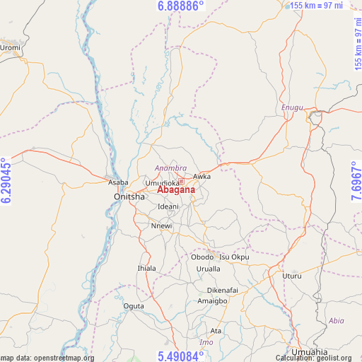
Abagana GPS coordinates[2]
6° 11' 25.116" North, 6° 59' 36.852" East
| Map corner | latitude | longitude |
|---|---|---|
| Upper-left | 6.88886°, | 6.29045° |
| Center: | 6.19031°, | 6.99357° |
| Lower-right: | 5.49084°, | 7.6967° |
| Map W x H: | 155.4×155.4 km | = 96.6×96.6mi |
| max Lat: | 13.7543° ⇑81.3% North |
| Abagana: | 6.19031° |
| min Lat: | ⇓18.7% South 4.31231° |
| min Long | Abagana | max Long |
| 2.73333° | 6.99357° | 14.46552° |
| W 43%⇐ | ⇒57% E |
Elevation
Elevation of Abagana is 174 m = 571 ft, and this is 122.5 m = 402 ft below average elevation for this country.
| Max E: |
1599 m = 5246 ft | 65.4% |
| Avg. | 296.5 m = 973 ft | |
| Abagana | 174 m = 571 ft | |
Min E: |
2 m = 7 ft | 34.6% |
See also: Nigeria elevation on elevation.city.
Geographical zone
Abagana is located in North Torrid zone (between Equator and Tropic of Cancer). Distance of Equator is 688.3 km =427.7 mi to South.| Distance of | km | miles | from Abagana |
|---|---|---|---|
| North Pole | 9318.8 | 5790.4 | to North |
| Arctic Circle | 6712.9 | 4171.2 | to North |
| Tropic Cancer | 1917.6 | 1191.5 | to North |
| Equator | 688.3 | 427.7 | to South |


Nearby cities:
15 places around Abagana: (largest is in red/bold)
• Achalla
16.1 km =10 mi,  358°
358°
• Aguata
22 km =13.7 mi,  151°
151°
• Agulu
12.5 km =7.8 mi,  143°
143°
• Awka
9 km =5.6 mi,  73°
73°
• Enugu-Ukwu
2.5 km =1.6 mi, 148°
• Igbo-Ukwu
19.4 km =12.1 mi,  171°
171°
• Neni
11.1 km =6.9 mi,  162°
162°
• Nkpor
18.6 km =11.6 mi,  256°
256°
• Nnewi
20.8 km =12.9 mi,  203°
203°
• Nteje
11.8 km =7.3 mi,  317°
317°
• Ogidi
15 km =9.3 mi,  253°
253°
• Ojoto
20.7 km =12.9 mi,  224°
224°
• Onitsha
23.4 km =14.5 mi, 258°
• Otuocha
23.2 km =14.4 mi, 315°
• Ukpo
4 km =2.5 mi,  311°
311°
Sources, notices
• [Note1] Compared only with cities in Nigeria existing in our database
• [Src1] Map data: © OpenStreetMap contributors (CC-BY-SA)
• [Src2] Other city data from geonames.org with taken over terms of usage.
• [Src3] Geographical zone / Annual Mean Temperature by Robert A. Rohde @ Wikipedia
