Igbo-Ukwu geodata
Igbo-Ukwu (Anambra) is a populated place; located in Nigeria in Africa/Lagos (GMT+1) time zone. With population of 75,224 people, there are 120 cities with bigger population in this country. Compared to other cities in Nigeria, 83.5% of cities are located further ↑North; 56.1% of cities are located further →East and 62.9% of cities have lower elevation than Igbo-Ukwu. Note1


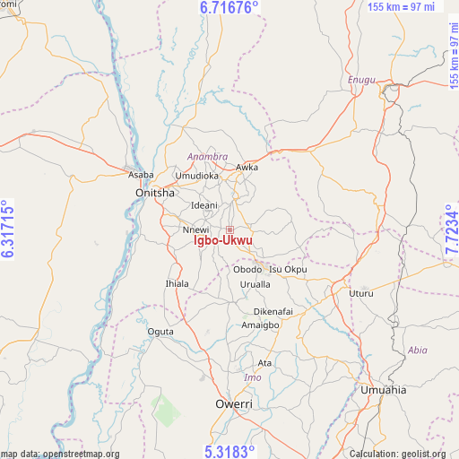
Igbo-Ukwu GPS coordinates[2]
6° 1' 4.728" North, 7° 1' 12.972" East
| Map corner | latitude | longitude |
|---|---|---|
| Upper-left | 6.71676°, | 6.31715° |
| Center: | 6.01798°, | 7.02027° |
| Lower-right: | 5.3183°, | 7.7234° |
| Map W x H: | 155.5×155.5 km | = 96.6×96.6mi |
| max Lat: | 13.7543° ⇑83.5% North |
| Igbo-Ukwu: | 6.01798° |
| min Lat: | ⇓16.5% South 4.31231° |
| min Long | Igbo-Ukwu | max Long |
| 2.73333° | 7.02027° | 14.46552° |
| W 43.9%⇐ | ⇒56.1% E |
Elevation
Elevation of Igbo-Ukwu is 359 m = 1178 ft, and this is 62.5 m = 205 ft above average elevation for this country.
| Max E: |
1599 m = 5246 ft | 37.1% |
| Igbo-Ukwu | 359 m 1178 ft | |
| Avg. | 296.5 m = 973 ft | |
Min E: |
2 m = 7 ft | 62.9% |
See also: Igbo-Ukwu elevation on elevation.city.
Geographical zone
Igbo-Ukwu is located in North Torrid zone (between Equator and Tropic of Cancer). Distance of Equator is 669.1 km =415.8 mi to South.| Distance of | km | miles | from Igbo-Ukwu |
|---|---|---|---|
| North Pole | 9337.9 | 5802.3 | to North |
| Arctic Circle | 6732 | 4183.1 | to North |
| Tropic Cancer | 1936.8 | 1203.5 | to North |
| Equator | 669.1 | 415.8 | to South |


Nearby cities:
15 places around Igbo-Ukwu: (largest is in red/bold)
• Abagana
19.4 km =12.1 mi,  351°
351°
• Aguata
7.5 km =4.7 mi,  91°
91°
• Agulu
10.2 km =6.3 mi,  26°
26°
• Ajalli
21 km =13 mi,  82°
82°
• Awka
22.4 km =13.9 mi,  14°
14°
• Enugu-Ukwu
17.1 km =10.6 mi, 354°
• Neni
8.6 km =5.3 mi,  2°
2°
• Nnewi
11.4 km =7.1 mi,  270°
270°
• Ogidi
22.9 km =14.2 mi,  310°
310°
• Ojoto
18.2 km =11.3 mi,  284°
284°
• Ozubulu
19.7 km =12.2 mi,  250°
250°
• Uga
11.2 km =7 mi,  144°
144°
• Ukpo
22.6 km =14 mi,  344°
344°
• Ukpor
13.1 km =8.1 mi,  230°
230°
• Urualla
20.2 km =12.6 mi,  154°
154°
Sources, notices
• [Note1] Compared only with cities in Nigeria existing in our database
• [Src1] Map data: © OpenStreetMap contributors (CC-BY-SA)
• [Src2] Other city data from geonames.org with taken over terms of usage.
• [Src3] Geographical zone / Annual Mean Temperature by Robert A. Rohde @ Wikipedia
