Matazu geodata
Matazu (Katsina) is a seat of a second-order administrative division; located in Nigeria in Africa/Lagos (GMT+1) time zone. In our database, there are 451 cities with bigger population. Compared to other cities in Nigeria, 87.3% of cities are located further ↓South; 57.2% of cities are located further ←West and 88.3% of cities have lower elevation than Matazu. Note1


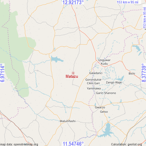
Matazu GPS coordinates[2]
12° 14' 7.764" North, 7° 40' 27.336" East
| Map corner | latitude | longitude |
|---|---|---|
| Upper-left | 12.92173°, | 6.97114° |
| Center: | 12.23549°, | 7.67426° |
| Lower-right: | 11.54746°, | 8.37739° |
| Map W x H: | 152.8×152.8 km | = 94.9×94.9mi |
| max Lat: | 13.7543° ⇑12.7% North |
| Matazu: | 12.23549° |
| min Lat: | ⇓87.3% South 4.31231° |
| min Long | Matazu | max Long |
| 2.73333° | 7.67426° | 14.46552° |
| W 57.2%⇐ | ⇒42.8% E |
Elevation
Elevation of Matazu is 535 m = 1755 ft, and this is 238.5 m = 782 ft above average elevation for this country.
| Max E: |
1599 m = 5246 ft | 11.7% |
| Matazu | 535 m 1755 ft | |
| Avg. | 296.5 m = 973 ft | |
Min E: |
2 m = 7 ft | 88.3% |
See also: Nigeria elevation on elevation.city.
Geographical zone
Matazu is located in North Torrid zone (between Equator and Tropic of Cancer). Distance of this Northern Tropic circle is 1245.5 km =773.9 mi to North.| Distance of | km | miles | from Matazu |
|---|---|---|---|
| North Pole | 8646.6 | 5372.7 | to North |
| Arctic Circle | 6040.7 | 3753.5 | to North |
| Tropic Cancer | 1245.5 | 773.9 | to North |
| Equator | 1360.5 | 845.4 | to South |


Nearby cities:
15 places around Matazu: (largest is in red/bold)
• Charanchi
48.9 km =30.4 mi,  7°
7°
• Dan Musa
37.1 km =23.1 mi,  274°
274°
• Dutsin-Ma
31 km =19.3 mi,  321°
321°
• Gora
35.9 km =22.3 mi,  181°
181°
• Gwarzo
45.4 km =28.2 mi,  141°
141°
• Jikamshi
12.9 km =8 mi,  122°
122°
• Kankara
44.3 km =27.5 mi,  220°
220°
• Kankia
38.1 km =23.7 mi,  24°
24°
• Kusada
41.8 km =26 mi,  52°
52°
• Malumfashi
49.9 km =31 mi,  186°
186°
• Musawa
11.8 km =7.3 mi, 182°
• Runka
46.2 km =28.7 mi,  300°
300°
• Safana
34.3 km =21.3 mi, 304°
• Shanono
40.1 km =24.9 mi, 120°
• Tsanyawa
34.6 km =21.5 mi,  78°
78°
Sources, notices
• [Note1] Compared only with cities in Nigeria existing in our database
• [Src1] Map data: © OpenStreetMap contributors (CC-BY-SA)
• [Src2] Other city data from geonames.org with taken over terms of usage.
• [Src3] Geographical zone / Annual Mean Temperature by Robert A. Rohde @ Wikipedia
