Dan Musa geodata
Dan Musa (Katsina) is a seat of a second-order administrative division; located in Nigeria in Africa/Lagos (GMT+1) time zone. In our database, there are 451 cities with bigger population. Compared to other cities in Nigeria, 87.6% of cities are located further ↓South; 50.2% of cities are located further ←West and 83.6% of cities have lower elevation than Dan Musa. Note1


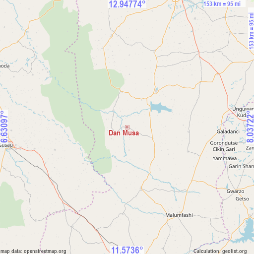
Dan Musa GPS coordinates[2]
12° 15' 41.652" North, 7° 20' 2.724" East
| Map corner | latitude | longitude |
|---|---|---|
| Upper-left | 12.94774°, | 6.63097° |
| Center: | 12.26157°, | 7.33409° |
| Lower-right: | 11.5736°, | 8.03722° |
| Map W x H: | 152.8×152.8 km | = 94.9×94.9mi |
| max Lat: | 13.7543° ⇑12.4% North |
| Dan Musa: | 12.26157° |
| min Lat: | ⇓87.6% South 4.31231° |
| min Long | Dan Musa | max Long |
| 2.73333° | 7.33409° | 14.46552° |
| W 50.2%⇐ | ⇒49.8% E |
Elevation
Elevation of Dan Musa is 492 m = 1614 ft, and this is 195.5 m = 641 ft above average elevation for this country.
| Max E: |
1599 m = 5246 ft | 16.4% |
| Dan Musa | 492 m 1614 ft | |
| Avg. | 296.5 m = 973 ft | |
Min E: |
2 m = 7 ft | 83.6% |
See also: Nigeria elevation on elevation.city.
Geographical zone
Dan Musa is located in North Torrid zone (between Equator and Tropic of Cancer). Distance of this Northern Tropic circle is 1242.6 km =772.1 mi to North.| Distance of | km | miles | from Dan Musa |
|---|---|---|---|
| North Pole | 8643.7 | 5370.9 | to North |
| Arctic Circle | 6037.8 | 3751.7 | to North |
| Tropic Cancer | 1242.6 | 772.1 | to North |
| Equator | 1363.4 | 847.2 | to South |


Nearby cities:
15 places around Dan Musa: (largest is in red/bold)
• Batsari
55.7 km =34.6 mi,  350°
350°
• Birnin Magaji
58.1 km =36.1 mi,  304°
304°
• Dutsin-Ma
27.8 km =17.3 mi,  39°
39°
• Gora
52.9 km =32.9 mi,  137°
137°
• Jikamshi
48.8 km =30.3 mi,  101°
101°
• Kankara
37.7 km =23.4 mi,  167°
167°
• Kurfi
47.9 km =29.8 mi,  19°
19°
• Kwatarkwashi
57.3 km =35.6 mi,  256°
256°
• Malumfashi
61.1 km =38 mi,  149°
149°
• Matazu
37.1 km =23.1 mi,  94°
94°
• Musawa
39.4 km =24.5 mi,  111°
111°
• Runka
20.9 km =13 mi, 352°
• Safana
18.7 km =11.6 mi,  27°
27°
• Tsafe
56.2 km =34.9 mi,  233°
233°
• Wagini
49.7 km =30.9 mi,  342°
342°
Sources, notices
• [Note1] Compared only with cities in Nigeria existing in our database
• [Src1] Map data: © OpenStreetMap contributors (CC-BY-SA)
• [Src2] Other city data from geonames.org with taken over terms of usage.
• [Src3] Geographical zone / Annual Mean Temperature by Robert A. Rohde @ Wikipedia
