Bode Saadu geodata
Bode Saadu (Kwara) is a seat of a second-order administrative division; located in Nigeria in Africa/Lagos (GMT+1) time zone. With population of 16,619 people, there are 221 cities with bigger population in this country. Compared to other cities in Nigeria, 54.3% of cities are located further ↓South; 84.3% of cities are located further →East and 69.5% of cities have higher elevation than Bode Saadu. Note1


Bode Saadu GPS coordinates[2]
8° 56' 20.4" North, 4° 46' 56.172" East
| Map corner | latitude | longitude |
|---|---|---|
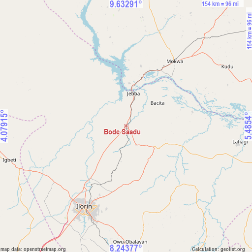
| Upper-left | 9.63291°, | 4.07915° |
| Center: | 8.939°, | 4.78227° |
| Lower-right: | 8.24377°, | 5.4854° |
| Map W x H: | 154.5×154.5 km | = 96×96mi |
| max Lat: | 13.7543° ⇑45.7% North |
| Bode Saadu: | 8.939° |
| min Lat: | ⇓54.3% South 4.31231° |
| min Long | Bode Saadu | max Long |
| 2.73333° | 4.78227° | 14.46552° |
| W 15.7%⇐ | ⇒84.3% E |
Elevation
Elevation of Bode Saadu is 151 m = 495 ft, and this is 145.5 m = 477 ft below average elevation for this country.
| Max E: |
1599 m = 5246 ft | 69.5% |
| Avg. | 296.5 m = 973 ft | |
| Bode Saadu | 151 m = 495 ft | |
Min E: |
2 m = 7 ft | 30.5% |
See also: Nigeria elevation on elevation.city.
Geographical zone
Bode Saadu is located in North Torrid zone (between Equator and Tropic of Cancer). Distance of Equator is 993.9 km =617.6 mi to South.| Distance of | km | miles | from Bode Saadu |
|---|---|---|---|
| North Pole | 9013.1 | 5600.5 | to North |
| Arctic Circle | 6407.3 | 3981.3 | to North |
| Tropic Cancer | 1612 | 1001.7 | to North |
| Equator | 993.9 | 617.6 | to South |


Nearby cities:
15 places around Bode Saadu: (largest is in red/bold)
• Afon
75 km =46.6 mi,  201°
201°
• Ajasse Ipo
78.6 km =48.8 mi,  177°
177°
• Alapa
56.6 km =35.2 mi,  230°
230°
• Bokani
71.6 km =44.5 mi,  39°
39°
• Enagi
86.2 km =53.6 mi,  75°
75°
• Fufu
55 km =34.2 mi,  187°
187°
• Igbeti
74.6 km =46.4 mi,  253°
253°
• Ilorin
55.8 km =34.7 mi,  208°
208°
• Jebba
20.6 km =12.8 mi,  12°
12°
• Lafiagi
70.3 km =43.7 mi,  97°
97°
• Mokwa
49.6 km =30.8 mi, 37°
• Offa
88.1 km =54.7 mi, 184°
• Oke-Oyi
40.3 km =25 mi, 190°
• Owu-Isin
77.7 km =48.3 mi,  160°
160°
• Share
24.8 km =15.4 mi,  122°
122°
Sources, notices
• [Note1] Compared only with cities in Nigeria existing in our database
• [Src1] Map data: © OpenStreetMap contributors (CC-BY-SA)
• [Src2] Other city data from geonames.org with taken over terms of usage.
• [Src3] Geographical zone / Annual Mean Temperature by Robert A. Rohde @ Wikipedia
