Oghara geodata
Oghara (Delta) is a seat of a second-order administrative division; located in Nigeria in Africa/Lagos (GMT+1) time zone. In our database, there are 451 cities with bigger population. Compared to other cities in Nigeria, 84.6% of cities are located further ↑North; 74.3% of cities are located further →East and 95.5% of cities have higher elevation than Oghara. Note1


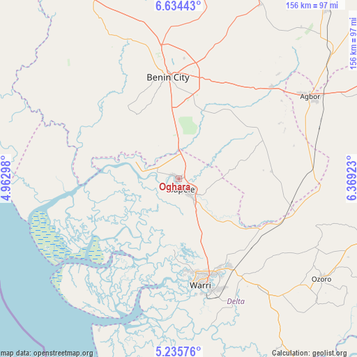
Oghara GPS coordinates[2]
5° 56' 7.944" North, 5° 39' 57.96" East
| Map corner | latitude | longitude |
|---|---|---|
| Upper-left | 6.63443°, | 4.96298° |
| Center: | 5.93554°, | 5.6661° |
| Lower-right: | 5.23576°, | 6.36923° |
| Map W x H: | 155.5×155.5 km | = 96.6×96.6mi |
| max Lat: | 13.7543° ⇑84.6% North |
| Oghara: | 5.93554° |
| min Lat: | ⇓15.4% South 4.31231° |
| min Long | Oghara | max Long |
| 2.73333° | 5.6661° | 14.46552° |
| W 25.7%⇐ | ⇒74.3% E |
Elevation
Elevation of Oghara is 11 m = 36 ft, and this is 285.5 m = 937 ft below average elevation for this country.
| Max E: |
1599 m = 5246 ft | 95.5% |
| Avg. | 296.5 m = 973 ft | |
| Oghara | 11 m = 36 ft | |
Min E: |
2 m = 7 ft | 4.5% |
See also: Nigeria elevation on elevation.city.
Geographical zone
Oghara is located in North Torrid zone (between Equator and Tropic of Cancer). Distance of Equator is 660 km =410.1 mi to South.| Distance of | km | miles | from Oghara |
|---|---|---|---|
| North Pole | 9347.1 | 5808 | to North |
| Arctic Circle | 6741.2 | 4188.8 | to North |
| Tropic Cancer | 1945.9 | 1209.1 | to North |
| Equator | 660 | 410.1 | to South |


Nearby cities:
15 places around Oghara: (largest is in red/bold)
• Abraka
51.1 km =31.8 mi,  108°
108°
• Abudu
56.7 km =35.2 mi,  45°
45°
• Benin City
45 km =28 mi,  354°
354°
• Effurun
44.2 km =27.5 mi,  162°
162°
• Idogbo
37.3 km =23.2 mi,  7°
7°
• Isiokolo
52.9 km =32.9 mi,  135°
135°
• Koko
24.4 km =15.2 mi,  287°
287°
• Obiaruku
54.7 km =34 mi,  100°
100°
• Orerokpe
41.4 km =25.7 mi, 143°
• Otor-Udu
58.1 km =36.1 mi, 157°
• Otu-Jeremi
60.1 km =37.3 mi, 156°
• Sapele
4.8 km =3 mi,  165°
165°
• Ughelli
62.1 km =38.6 mi, 142°
• Uselu
50.3 km =31.3 mi, 352°
• Warri
47.4 km =29.5 mi, 168°
Sources, notices
• [Note1] Compared only with cities in Nigeria existing in our database
• [Src1] Map data: © OpenStreetMap contributors (CC-BY-SA)
• [Src2] Other city data from geonames.org with taken over terms of usage.
• [Src3] Geographical zone / Annual Mean Temperature by Robert A. Rohde @ Wikipedia
