Onueke geodata
Onueke (Ebonyi) is a seat of a second-order administrative division; located in Nigeria in Africa/Lagos (GMT+1) time zone. In our database, there are 451 cities with bigger population. Compared to other cities in Nigeria, 81.9% of cities are located further ↑North; 64.3% of cities are located further ←West and 78.5% of cities have higher elevation than Onueke. Note1


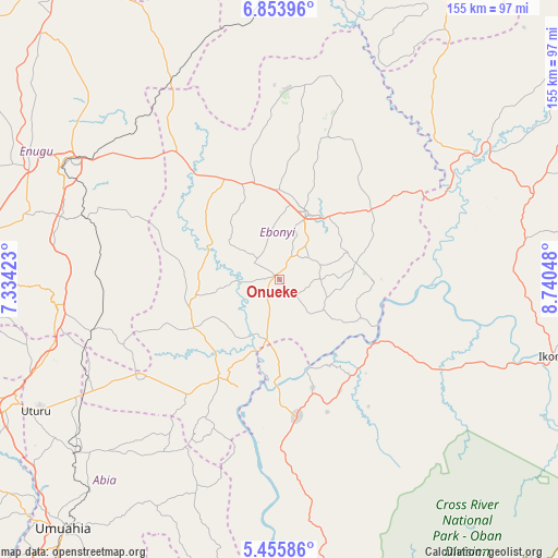
Onueke GPS coordinates[2]
6° 9' 19.332" North, 8° 2' 14.46" East
| Map corner | latitude | longitude |
|---|---|---|
| Upper-left | 6.85396°, | 7.33423° |
| Center: | 6.15537°, | 8.03735° |
| Lower-right: | 5.45586°, | 8.74048° |
| Map W x H: | 155.5×155.5 km | = 96.6×96.6mi |
| max Lat: | 13.7543° ⇑81.9% North |
| Onueke: | 6.15537° |
| min Lat: | ⇓18.1% South 4.31231° |
| min Long | Onueke | max Long |
| 2.73333° | 8.03735° | 14.46552° |
| W 64.3%⇐ | ⇒35.7% E |
Elevation
Elevation of Onueke is 91 m = 299 ft, and this is 205.5 m = 674 ft below average elevation for this country.
| Max E: |
1599 m = 5246 ft | 78.5% |
| Avg. | 296.5 m = 973 ft | |
| Onueke | 91 m = 299 ft | |
Min E: |
2 m = 7 ft | 21.5% |
See also: Nigeria elevation on elevation.city.
Geographical zone
Onueke is located in North Torrid zone (between Equator and Tropic of Cancer). Distance of Equator is 684.4 km =425.3 mi to South.| Distance of | km | miles | from Onueke |
|---|---|---|---|
| North Pole | 9322.6 | 5792.8 | to North |
| Arctic Circle | 6716.8 | 4173.6 | to North |
| Tropic Cancer | 1921.5 | 1194 | to North |
| Equator | 684.4 | 425.3 | to South |


Nearby cities:
15 places around Onueke: (largest is in red/bold)
• Abakaliki
20.6 km =12.8 mi,  24°
24°
• Afikpo
31.3 km =19.4 mi,  201°
201°
• Ezillo
38.9 km =24.2 mi,  321°
321°
• Ezza-Ohu
32.2 km =20 mi,  9°
9°
• Ezzamgbo
28.3 km =17.6 mi,  342°
342°
• Iboko
35.3 km =21.9 mi,  37°
37°
• Isieke
25.2 km =15.7 mi,  0°
0°
• Isu
26.1 km =16.2 mi,  268°
268°
• Itigidi
29.4 km =18.3 mi,  183°
183°
• Mberubu
45.1 km =28 mi, 272°
• Obiozara
31.7 km =19.7 mi,  247°
247°
• Obubra
33.8 km =21 mi,  105°
105°
• Onuebonyi Echara
14.3 km =8.9 mi,  117°
117°
• Ugbodo
40.9 km =25.4 mi, 14°
• Ugep
38.9 km =24.2 mi,  172°
172°
Sources, notices
• [Note1] Compared only with cities in Nigeria existing in our database
• [Src1] Map data: © OpenStreetMap contributors (CC-BY-SA)
• [Src2] Other city data from geonames.org with taken over terms of usage.
• [Src3] Geographical zone / Annual Mean Temperature by Robert A. Rohde @ Wikipedia
