Villa Sandino geodata
Villa Sandino (Chontales) is a seat of a second-order administrative division; located in Nicaragua in America/Managua (GMT-6) time zone. With population of 7,799 people, there are 51 cities with bigger population in this country. Compared to other cities in Nicaragua, 71.3% of cities are located further ↑North; 85.6% of cities are located further ←West and 52.1% of cities have lower elevation than Villa Sandino. Note1


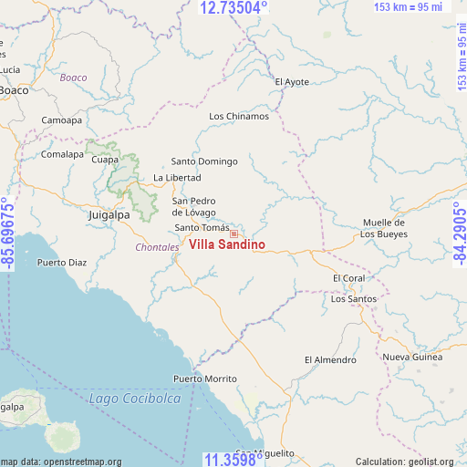
Villa Sandino GPS coordinates[2]
12° 2' 53.88" North, 84° 59' 37.032" West
| Map corner | latitude | longitude |
|---|---|---|
| Upper-left | 12.73504°, | -85.69675° |
| Center: | 12.0483°, | -84.99362° |
| Lower-right: | 11.3598°, | -84.2905° |
| Map W x H: | 152.9×152.9 km | = 95×95mi |
| max Lat: | 14.74189° ⇑71.3% North |
| Villa Sandino: | 12.0483° |
| min Lat: | ⇓28.7% South 10.94684° |
| min Long | Villa Sandino | max Long |
| -87.4516° | -84.99362° | -83.06145° |
| W 85.6%⇐ | ⇒14.4% E |
Elevation
Elevation of Villa Sandino is 306 m = 1004 ft, and this is 31.2 m = 102 ft below average elevation for this country.
| Max E: |
1288 m = 4226 ft | 47.9% |
| Avg. | 337.2 m = 1106 ft | |
| Villa Sandino | 306 m = 1004 ft | |
Min E: |
1 m = 3 ft | 52.1% |
See also: Nicaragua elevation on elevation.city.
Geographical zone
Villa Sandino is located in North Torrid zone (between Equator and Tropic of Cancer). Distance of this Northern Tropic circle is 1266.3 km =786.8 mi to North.| Distance of | km | miles | from Villa Sandino |
|---|---|---|---|
| North Pole | 8667.4 | 5385.7 | to North |
| Arctic Circle | 6061.5 | 3766.4 | to North |
| Tropic Cancer | 1266.3 | 786.8 | to North |
| Equator | 1339.6 | 832.4 | to South |


Nearby cities:
15 places around Villa Sandino: (largest is in red/bold)
• Acoyapa
21.2 km =13.2 mi,  245°
245°
• Camoapa
67.6 km =42 mi,  303°
303°
• Comalapa
62 km =38.5 mi,  294°
294°
• Cuapa
48.8 km =30.3 mi, 300°
• El Almendro
51.9 km =32.2 mi,  142°
142°
• El Ayote
35.6 km =22.1 mi, 296°
• El Ayote
53.8 km =33.4 mi,  21°
21°
• El Coral
40.3 km =25 mi,  111°
111°
• Juigalpa
40.8 km =25.4 mi,  279°
279°
• La Libertad
26.5 km =16.5 mi,  314°
314°
• Morrito
48.4 km =30.1 mi,  191°
191°
• Muelle de los Bueyes
49.9 km =31 mi,  87°
87°
• San Pedro de Lóvago
16 km =9.9 mi, 304°
• Santo Domingo
25.9 km =16.1 mi,  338°
338°
• Santo Tomás
10.8 km =6.7 mi, 282°
Sources, notices
• [Note1] Compared only with cities in Nicaragua existing in our database
• [Src1] Map data: © OpenStreetMap contributors (CC-BY-SA)
• [Src2] Other city data from geonames.org with taken over terms of usage.
• [Src3] Geographical zone / Annual Mean Temperature by Robert A. Rohde @ Wikipedia
