El Coral geodata
El Coral (Chontales) is a seat of a second-order administrative division; located in Nicaragua in America/Managua (GMT-6) time zone. In our database, there are 137 cities with bigger population. Compared to other cities in Nicaragua, 77.8% of cities are located further ↑North; 89.8% of cities are located further ←West and 62.9% of cities have higher elevation than El Coral. Note1


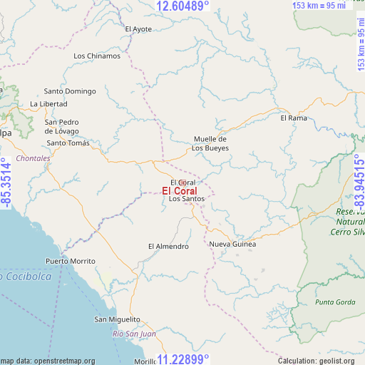
El Coral GPS coordinates[2]
11° 55' 4.116" North, 84° 38' 53.772" West
| Map corner | latitude | longitude |
|---|---|---|
| Upper-left | 12.60489°, | -85.3514° |
| Center: | 11.91781°, | -84.64827° |
| Lower-right: | 11.22899°, | -83.94515° |
| Map W x H: | 153×153 km | = 95.1×95.1mi |
| max Lat: | 14.74189° ⇑77.8% North |
| El Coral: | 11.91781° |
| min Lat: | ⇓22.2% South 10.94684° |
| min Long | El Coral | max Long |
| -87.4516° | -84.64827° | -83.06145° |
| W 89.8%⇐ | ⇒10.2% E |
Elevation
Elevation of El Coral is 127 m = 417 ft, and this is 210.2 m = 690 ft below average elevation for this country.
| Max E: |
1288 m = 4226 ft | 62.9% |
| Avg. | 337.2 m = 1106 ft | |
| El Coral | 127 m = 417 ft | |
Min E: |
1 m = 3 ft | 37.1% |
See also: Nicaragua elevation on elevation.city.
Geographical zone
El Coral is located in North Torrid zone (between Equator and Tropic of Cancer). Distance of this Northern Tropic circle is 1280.8 km =795.9 mi to North.| Distance of | km | miles | from El Coral |
|---|---|---|---|
| North Pole | 8681.9 | 5394.7 | to North |
| Arctic Circle | 6076 | 3775.5 | to North |
| Tropic Cancer | 1280.8 | 795.9 | to North |
| Equator | 1325.1 | 823.4 | to South |


Nearby cities:
15 places around El Coral: (largest is in red/bold)
• Acoyapa
57.2 km =35.5 mi,  275°
275°
• El Almendro
27.3 km =17 mi,  192°
192°
• El Ayote
67.2 km =41.8 mi,  344°
344°
• El Ayote
75.8 km =47.1 mi,  293°
293°
• El Rama
53.8 km =33.4 mi,  60°
60°
• Juigalpa
80.7 km =50.1 mi, 285°
• La Libertad
65.3 km =40.6 mi,  300°
300°
• Morrito
57.5 km =35.7 mi,  234°
234°
• Muelle de los Bueyes
20.9 km =13 mi,  36°
36°
• Nueva Guinea
33.1 km =20.6 mi,  140°
140°
• San Miguelito
63.5 km =39.5 mi,  205°
205°
• San Pedro de Lóvago
56 km =34.8 mi, 294°
• Santo Domingo
60.9 km =37.8 mi,  309°
309°
• Santo Tomás
51 km =31.7 mi, 289°
• Villa Sandino
40.3 km =25 mi, 291°
Sources, notices
• [Note1] Compared only with cities in Nicaragua existing in our database
• [Src1] Map data: © OpenStreetMap contributors (CC-BY-SA)
• [Src2] Other city data from geonames.org with taken over terms of usage.
• [Src3] Geographical zone / Annual Mean Temperature by Robert A. Rohde @ Wikipedia
