Larreynaga geodata
Larreynaga (León) is a populated place; located in Nicaragua in America/Managua (GMT-6) time zone. With population of 7,703 people, there are 54 cities with bigger population in this country. Compared to other cities in Nicaragua, 53.3% of cities are located further ↓South; 82.6% of cities are located further →East and 71.3% of cities have higher elevation than Larreynaga. Note1


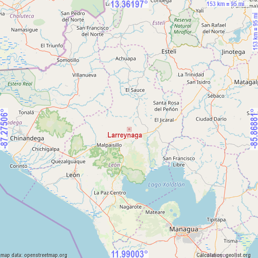
Larreynaga GPS coordinates[2]
12° 40' 36.912" North, 86° 34' 18.948" West
| Map corner | latitude | longitude |
|---|---|---|
| Upper-left | 13.36197°, | -87.27506° |
| Center: | 12.67692°, | -86.57193° |
| Lower-right: | 11.99003°, | -85.86881° |
| Map W x H: | 152.5×152.5 km | = 94.8×94.8mi |
| max Lat: | 14.74189° ⇑46.7% North |
| Larreynaga: | 12.67692° |
| min Lat: | ⇓53.3% South 10.94684° |
| min Long | Larreynaga | max Long |
| -87.4516° | -86.57193° | -83.06145° |
| W 17.4%⇐ | ⇒82.6% E |
Elevation
Elevation of Larreynaga is 97 m = 318 ft, and this is 240.2 m = 788 ft below average elevation for this country.
| Max E: |
1288 m = 4226 ft | 71.3% |
| Avg. | 337.2 m = 1106 ft | |
| Larreynaga | 97 m = 318 ft | |
Min E: |
1 m = 3 ft | 28.7% |
See also: Nicaragua elevation on elevation.city.
Geographical zone
Larreynaga is located in North Torrid zone (between Equator and Tropic of Cancer). Distance of this Northern Tropic circle is 1196.4 km =743.4 mi to North.| Distance of | km | miles | from Larreynaga |
|---|---|---|---|
| North Pole | 8597.5 | 5342.2 | to North |
| Arctic Circle | 5991.6 | 3723 | to North |
| Tropic Cancer | 1196.4 | 743.4 | to North |
| Equator | 1409.5 | 875.8 | to South |


Nearby cities:
15 places around Larreynaga: (largest is in red/bold)
• Achuapa
41.9 km =26 mi,  357°
357°
• El Jicaral
21.5 km =13.4 mi,  75°
75°
• El Sauce
23.6 km =14.7 mi,  8°
8°
• La Paz Centro
39.1 km =24.3 mi,  196°
196°
• León
42.5 km =26.4 mi,  231°
231°
• Malpaisillo
14.9 km =9.3 mi, 231°
• Nagarote
45.7 km =28.4 mi,  179°
179°
• Posoltega
46.7 km =29 mi,  251°
251°
• Quezalguaque
40.6 km =25.2 mi,  242°
242°
• San Francisco Libre
35.2 km =21.9 mi,  122°
122°
• San Nicolás
37.4 km =23.2 mi,  40°
40°
• Santa Rosa del Peñón
25.9 km =16.1 mi,  57°
57°
• Telica
35.6 km =22.1 mi, 241°
• Valle San Francisco
36 km =22.4 mi, 119°
• Villanueva
41.4 km =25.7 mi,  320°
320°
Sources, notices
• [Note1] Compared only with cities in Nicaragua existing in our database
• [Src1] Map data: © OpenStreetMap contributors (CC-BY-SA)
• [Src2] Other city data from geonames.org with taken over terms of usage.
• [Src3] Geographical zone / Annual Mean Temperature by Robert A. Rohde @ Wikipedia
