San Miguelito geodata
San Miguelito (Río San Juan) is a seat of a second-order administrative division; located in Nicaragua in America/Managua (GMT-6) time zone. With population of 4,181 people, there are 82 cities with bigger population in this country. Compared to other cities in Nicaragua, 96.4% of cities are located further ↑North; 86.8% of cities are located further ←West and 85.6% of cities have higher elevation than San Miguelito. Note1


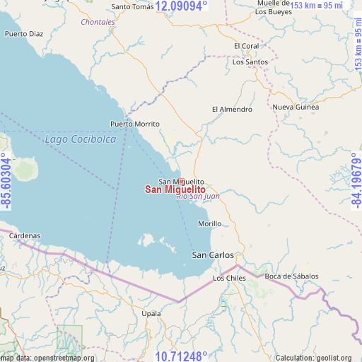
San Miguelito GPS coordinates[2]
11° 24' 9.18" North, 84° 53' 59.676" West
| Map corner | latitude | longitude |
|---|---|---|
| Upper-left | 12.09094°, | -85.60304° |
| Center: | 11.40255°, | -84.89991° |
| Lower-right: | 10.71248°, | -84.19679° |
| Map W x H: | 153.3×153.3 km | = 95.3×95.3mi |
| max Lat: | 14.74189° ⇑96.4% North |
| San Miguelito: | 11.40255° |
| min Lat: | ⇓3.6% South 10.94684° |
| min Long | San Miguelito | max Long |
| -87.4516° | -84.89991° | -83.06145° |
| W 86.8%⇐ | ⇒13.2% E |
Elevation
Elevation of San Miguelito is 49 m = 161 ft, and this is 288.2 m = 946 ft below average elevation for this country.
| Max E: |
1288 m = 4226 ft | 85.6% |
| Avg. | 337.2 m = 1106 ft | |
| San Miguelito | 49 m = 161 ft | |
Min E: |
1 m = 3 ft | 14.4% |
See also: Nicaragua elevation on elevation.city.
Geographical zone
San Miguelito is located in North Torrid zone (between Equator and Tropic of Cancer). Distance of Equator is 1267.8 km =787.8 mi to South.| Distance of | km | miles | from San Miguelito |
|---|---|---|---|
| North Pole | 8739.2 | 5430.3 | to North |
| Arctic Circle | 6133.3 | 3811.1 | to North |
| Tropic Cancer | 1338.1 | 831.5 | to North |
| Equator | 1267.8 | 787.8 | to South |


Nearby cities:
15 places around San Miguelito: (largest is in red/bold)
• Acoyapa
69.7 km =43.3 mi,  334°
334°
• Altagracia
76.1 km =47.3 mi,  283°
283°
• Boca de Sábalos
61.4 km =38.2 mi,  129°
129°
• Cárdenas
70.2 km =43.6 mi,  250°
250°
• El Almendro
37.5 km =23.3 mi,  34°
34°
• El Castillo de La Concepción
69.4 km =43.1 mi, 127°
• El Coral
63.5 km =39.5 mi, 25°
• Morrito
31.3 km =19.4 mi,  321°
321°
• Moyogalpa
88.3 km =54.9 mi, 279°
• Muelle de los Bueyes
84.2 km =52.3 mi, 28°
• Nueva Guinea
57.8 km =35.9 mi,  56°
56°
• San Carlos
33.7 km =20.9 mi,  156°
156°
• San Pedro de Lóvago
84.2 km =52.3 mi,  343°
343°
• Santo Tomás
77 km =47.8 mi, 344°
• Villa Sandino
72.5 km =45 mi,  351°
351°
Sources, notices
• [Note1] Compared only with cities in Nicaragua existing in our database
• [Src1] Map data: © OpenStreetMap contributors (CC-BY-SA)
• [Src2] Other city data from geonames.org with taken over terms of usage.
• [Src3] Geographical zone / Annual Mean Temperature by Robert A. Rohde @ Wikipedia
