San Carlos geodata
San Carlos (Río San Juan) is a seat of a first-order administrative division; located in Nicaragua in America/Managua (GMT-6) time zone. With population of 13,451 people, there are 38 cities with bigger population in this country. Compared to other cities in Nicaragua, 98.2% of cities are located further ↑North; 88% of cities are located further ←West and 83.2% of cities have higher elevation than San Carlos. Note1


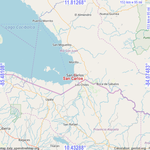
San Carlos GPS coordinates[2]
11° 7' 24.96" North, 84° 46' 40.62" West
| Map corner | latitude | longitude |
|---|---|---|
| Upper-left | 11.81268°, | -85.48108° |
| Center: | 11.1236°, | -84.77795° |
| Lower-right: | 10.43288°, | -84.07483° |
| Map W x H: | 153.4×153.4 km | = 95.3×95.3mi |
| max Lat: | 14.74189° ⇑98.2% North |
| San Carlos: | 11.1236° |
| min Lat: | ⇓1.8% South 10.94684° |
| min Long | San Carlos | max Long |
| -87.4516° | -84.77795° | -83.06145° |
| W 88%⇐ | ⇒12% E |
Elevation
Elevation of San Carlos is 51 m = 167 ft, and this is 286.2 m = 939 ft below average elevation for this country.
| Max E: |
1288 m = 4226 ft | 83.2% |
| Avg. | 337.2 m = 1106 ft | |
| San Carlos | 51 m = 167 ft | |
Min E: |
1 m = 3 ft | 16.8% |
See also: Nicaragua elevation on elevation.city.
Geographical zone
San Carlos is located in North Torrid zone (between Equator and Tropic of Cancer). Distance of Equator is 1236.8 km =768.5 mi to South.| Distance of | km | miles | from San Carlos |
|---|---|---|---|
| North Pole | 8770.2 | 5449.5 | to North |
| Arctic Circle | 6164.3 | 3830.3 | to North |
| Tropic Cancer | 1369.1 | 850.7 | to North |
| Equator | 1236.8 | 768.5 | to South |


Nearby cities:
15 places around San Carlos: (largest is in red/bold)
• Acoyapa
103.4 km =64.2 mi,  335°
335°
• Altagracia
100.2 km =62.3 mi,  299°
299°
• Boca de Sábalos
34.9 km =21.7 mi,  103°
103°
• Cárdenas
80.1 km =49.8 mi,  275°
275°
• El Almendro
62.3 km =38.7 mi,  7°
7°
• El Castillo de La Concepción
43.1 km =26.8 mi,  105°
105°
• El Coral
89.4 km =55.6 mi, 9°
• Greytown
115.5 km =71.8 mi, 99°
• Morrito
64.4 km =40 mi,  329°
329°
• Moyogalpa
110.5 km =68.7 mi,  294°
294°
• Muelle de los Bueyes
108.5 km =67.4 mi, 14°
• Nueva Guinea
71.9 km =44.7 mi,  29°
29°
• San Miguelito
33.7 km =20.9 mi, 336°
• Santo Tomás
110.5 km =68.7 mi, 342°
• Villa Sandino
105.5 km =65.6 mi,  347°
347°
Sources, notices
• [Note1] Compared only with cities in Nicaragua existing in our database
• [Src1] Map data: © OpenStreetMap contributors (CC-BY-SA)
• [Src2] Other city data from geonames.org with taken over terms of usage.
• [Src3] Geographical zone / Annual Mean Temperature by Robert A. Rohde @ Wikipedia
