San José de Cusmapa geodata
San José de Cusmapa (Madriz) is a seat of a second-order administrative division; located in Nicaragua in America/Managua (GMT-6) time zone. With population of 1,419 people, there are 119 cities with bigger population in this country. Compared to other cities in Nicaragua, 78.4% of cities are located further ↓South; 86.8% of cities are located further →East and 100% of cities have lower elevation than San José de Cusmapa. Note1


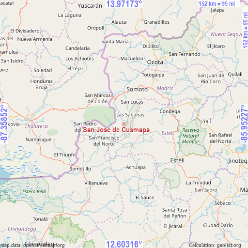
San José de Cusmapa GPS coordinates[2]
13° 17' 18.276" North, 86° 39' 19.404" West
| Map corner | latitude | longitude |
|---|---|---|
| Upper-left | 13.97173°, | -87.35852° |
| Center: | 13.28841°, | -86.65539° |
| Lower-right: | 12.60316°, | -85.95227° |
| Map W x H: | 152.2×152.2 km | = 94.6×94.6mi |
| max Lat: | 14.74189° ⇑21.6% North |
| San José de Cusmapa: | 13.28841° |
| min Lat: | ⇓78.4% South 10.94684° |
| min Long | San José de Cu | max Long |
| -87.4516° | -86.65539° | -83.06145° |
| W 13.2%⇐ | ⇒86.8% E |
Elevation
Elevation of San José de Cusmapa is 1288 m = 4226 ft, and this is 950.8 m = 3119 ft above average elevation for this country.
| Max E: |
1288 m = 4226 ft | 0% |
| San José de Cusmapa | 1288 m 4226 ft | |
| Avg. | 337.2 m = 1106 ft | |
Min E: |
1 m = 3 ft | 100% |
See also: Nicaragua elevation on elevation.city.
Geographical zone
San José de Cusmapa is located in North Torrid zone (between Equator and Tropic of Cancer). Distance of this Northern Tropic circle is 1128.4 km =701.2 mi to North.| Distance of | km | miles | from San José de Cusmapa |
|---|---|---|---|
| North Pole | 8529.5 | 5300 | to North |
| Arctic Circle | 5923.6 | 3680.8 | to North |
| Tropic Cancer | 1128.4 | 701.2 | to North |
| Equator | 1477.5 | 918.1 | to South |


Nearby cities:
15 places around San José de Cusmapa: (largest is in red/bold)
• Achuapa
27 km =16.8 mi,  164°
164°
• Cinco Pinos
23.9 km =14.9 mi,  254°
254°
• Condega
29.1 km =18.1 mi,  72°
72°
• Las Sabanas
7.1 km =4.4 mi,  30°
30°
• Palacagüina
32.7 km =20.3 mi,  55°
55°
• Pueblo Nuevo
21.5 km =13.4 mi, 61°
• San Francisco del Norte
16 km =9.9 mi,  231°
231°
• San Juan de Limay
13.3 km =8.3 mi, 159°
• San Lucas
14.7 km =9.1 mi,  18°
18°
• San Pedro del Norte
24.1 km =15 mi,  266°
266°
• Santo Tomás del Norte
31.1 km =19.3 mi, 248°
• Somotillo
38.3 km =23.8 mi,  224°
224°
• Somoto
22.8 km =14.2 mi, 20°
• Totogalpa
35.2 km =21.9 mi, 29°
• Yalagüina
27.9 km =17.3 mi,  38°
38°
Sources, notices
• [Note1] Compared only with cities in Nicaragua existing in our database
• [Src1] Map data: © OpenStreetMap contributors (CC-BY-SA)
• [Src2] Other city data from geonames.org with taken over terms of usage.
• [Src3] Geographical zone / Annual Mean Temperature by Robert A. Rohde @ Wikipedia
