Nagarote geodata
Nagarote (León) is a seat of a second-order administrative division; located in Nicaragua in America/Managua (GMT-6) time zone. With population of 26,270 people, there are 22 cities with bigger population in this country. Compared to other cities in Nicaragua, 61.7% of cities are located further ↑North; 82% of cities are located further →East and 73.1% of cities have higher elevation than Nagarote. Note1


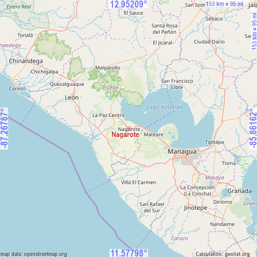
Nagarote GPS coordinates[2]
12° 15' 57.348" North, 86° 33' 53.064" West
| Map corner | latitude | longitude |
|---|---|---|
| Upper-left | 12.95209°, | -87.26787° |
| Center: | 12.26593°, | -86.56474° |
| Lower-right: | 11.57798°, | -85.86162° |
| Map W x H: | 152.8×152.8 km | = 94.9×94.9mi |
| max Lat: | 14.74189° ⇑61.7% North |
| Nagarote: | 12.26593° |
| min Lat: | ⇓38.3% South 10.94684° |
| min Long | Nagarote | max Long |
| -87.4516° | -86.56474° | -83.06145° |
| W 18%⇐ | ⇒82% E |
Elevation
Elevation of Nagarote is 86 m = 282 ft, and this is 251.2 m = 824 ft below average elevation for this country.
| Max E: |
1288 m = 4226 ft | 73.1% |
| Avg. | 337.2 m = 1106 ft | |
| Nagarote | 86 m = 282 ft | |
Min E: |
1 m = 3 ft | 26.9% |
See also: Nicaragua elevation on elevation.city.
Geographical zone
Nagarote is located in North Torrid zone (between Equator and Tropic of Cancer). Distance of this Northern Tropic circle is 1242.1 km =771.8 mi to North.| Distance of | km | miles | from Nagarote |
|---|---|---|---|
| North Pole | 8643.2 | 5370.6 | to North |
| Arctic Circle | 6037.3 | 3751.4 | to North |
| Tropic Cancer | 1242.1 | 771.8 | to North |
| Equator | 1363.8 | 847.4 | to South |


Nearby cities:
15 places around Nagarote: (largest is in red/bold)
• Ciudad Sandino
26.8 km =16.7 mi,  116°
116°
• El Crucero
41.4 km =25.7 mi,  137°
137°
• La Paz Centro
14.6 km =9.1 mi,  304°
304°
• Larreynaga
45.7 km =28.4 mi,  359°
359°
• León
39 km =24.2 mi, 299°
• Malpaisillo
38.5 km =23.9 mi,  341°
341°
• Managua
37.2 km =23.1 mi,  113°
113°
• Mateare
15.2 km =9.4 mi,  102°
102°
• Quezalguaque
45.5 km =28.3 mi,  306°
306°
• San Francisco Libre
39.2 km =24.4 mi,  47°
47°
• San Rafael del Sur
48.4 km =30.1 mi,  163°
163°
• Telica
42.8 km =26.6 mi, 311°
• Ticuantepe
47.6 km =29.6 mi, 124°
• Valle San Francisco
41.4 km =25.7 mi, 47°
• Villa El Carmen
32.4 km =20.1 mi,  168°
168°
Sources, notices
• [Note1] Compared only with cities in Nicaragua existing in our database
• [Src1] Map data: © OpenStreetMap contributors (CC-BY-SA)
• [Src2] Other city data from geonames.org with taken over terms of usage.
• [Src3] Geographical zone / Annual Mean Temperature by Robert A. Rohde @ Wikipedia
