Macuelizo geodata
Macuelizo (Nueva Segovia) is a seat of a second-order administrative division; located in Nicaragua in America/Managua (GMT-6) time zone. With population of 374 people, there are 136 cities with bigger population in this country. Compared to other cities in Nicaragua, 92.8% of cities are located further ↓South; 85.6% of cities are located further →East and 88% of cities have lower elevation than Macuelizo. Note1


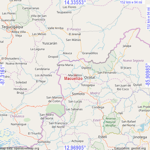
Macuelizo GPS coordinates[2]
13° 39' 11.808" North, 86° 36' 46.692" West
| Map corner | latitude | longitude |
|---|---|---|
| Upper-left | 14.33553°, | -87.3161° |
| Center: | 13.65328°, | -86.61297° |
| Lower-right: | 12.96905°, | -85.90985° |
| Map W x H: | 151.9×151.9 km | = 94.4×94.4mi |
| max Lat: | 14.74189° ⇑7.2% North |
| Macuelizo: | 13.65328° |
| min Lat: | ⇓92.8% South 10.94684° |
| min Long | Macuelizo | max Long |
| -87.4516° | -86.61297° | -83.06145° |
| W 14.4%⇐ | ⇒85.6% E |
Elevation
Elevation of Macuelizo is 694 m = 2277 ft, and this is 356.8 m = 1171 ft above average elevation for this country.
| Max E: |
1288 m = 4226 ft | 12% |
| Macuelizo | 694 m 2277 ft | |
| Avg. | 337.2 m = 1106 ft | |
Min E: |
1 m = 3 ft | 88% |
See also: Nicaragua elevation on elevation.city.
Geographical zone
Macuelizo is located in North Torrid zone (between Equator and Tropic of Cancer). Distance of this Northern Tropic circle is 1087.8 km =675.9 mi to North.| Distance of | km | miles | from Macuelizo |
|---|---|---|---|
| North Pole | 8489 | 5274.8 | to North |
| Arctic Circle | 5883.1 | 3655.6 | to North |
| Tropic Cancer | 1087.8 | 675.9 | to North |
| Equator | 1518.1 | 943.3 | to South |


Nearby cities:
15 places around Macuelizo: (largest is in red/bold)
• Ciudad Antigua
33 km =20.5 mi,  92°
92°
• Condega
39.6 km =24.6 mi,  144°
144°
• Dipilto
13.8 km =8.6 mi,  56°
56°
• Las Sabanas
34.5 km =21.4 mi,  181°
181°
• Mozonte
18.9 km =11.7 mi, 87°
• Ocotal
15.1 km =9.4 mi,  98°
98°
• Palacagüina
31.3 km =19.4 mi,  134°
134°
• Pueblo Nuevo
33.6 km =20.9 mi,  154°
154°
• San Fernando
32.3 km =20.1 mi, 85°
• San Lucas
26.6 km =16.5 mi, 179°
• Santa María
14.7 km =9.1 mi,  314°
314°
• Somoto
19.5 km =12.1 mi,  170°
170°
• Telpaneca
37.7 km =23.4 mi,  111°
111°
• Totogalpa
16.4 km =10.2 mi, 127°
• Yalagüina
22.9 km =14.2 mi, 145°
Sources, notices
• [Note1] Compared only with cities in Nicaragua existing in our database
• [Src1] Map data: © OpenStreetMap contributors (CC-BY-SA)
• [Src2] Other city data from geonames.org with taken over terms of usage.
• [Src3] Geographical zone / Annual Mean Temperature by Robert A. Rohde @ Wikipedia
