Santa María geodata
Santa María (Nueva Segovia) is a seat of a second-order administrative division; located in Nicaragua in America/Managua (GMT-6) time zone. With population of 720 people, there are 131 cities with bigger population in this country. Compared to other cities in Nicaragua, 96.4% of cities are located further ↓South; 88.6% of cities are located further →East and 91.6% of cities have lower elevation than Santa María. Note1


Santa María GPS coordinates[2]
13° 44' 47.94" North, 86° 42' 33.624" West
| Map corner | latitude | longitude |
|---|---|---|
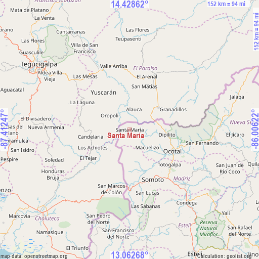
| Upper-left | 14.42862°, | -87.41247° |
| Center: | 13.74665°, | -86.70934° |
| Lower-right: | 13.06268°, | -86.00622° |
| Map W x H: | 151.9×151.9 km | = 94.4×94.4mi |
| max Lat: | 14.74189° ⇑3.6% North |
| Santa María: | 13.74665° |
| min Lat: | ⇓96.4% South 10.94684° |
| min Long | Santa María | max Long |
| -87.4516° | -86.70934° | -83.06145° |
| W 11.4%⇐ | ⇒88.6% E |
Elevation
Elevation of Santa María is 778 m = 2552 ft, and this is 440.8 m = 1446 ft above average elevation for this country.
| Max E: |
1288 m = 4226 ft | 8.4% |
| Santa María | 778 m 2552 ft | |
| Avg. | 337.2 m = 1106 ft | |
Min E: |
1 m = 3 ft | 91.6% |
See also: Nicaragua elevation on elevation.city.
Geographical zone
Santa María is located in North Torrid zone (between Equator and Tropic of Cancer). Distance of this Northern Tropic circle is 1077.4 km =669.5 mi to North.| Distance of | km | miles | from Santa María |
|---|---|---|---|
| North Pole | 8478.6 | 5268.4 | to North |
| Arctic Circle | 5872.7 | 3649.1 | to North |
| Tropic Cancer | 1077.4 | 669.5 | to North |
| Equator | 1528.5 | 949.8 | to South |


Nearby cities:
15 places around Santa María: (largest is in red/bold)
• Ciudad Antigua
44.9 km =27.9 mi,  105°
105°
• Dipilto
22.1 km =13.7 mi,  97°
97°
• Las Sabanas
45.9 km =28.5 mi,  168°
168°
• Macuelizo
14.7 km =9.1 mi,  134°
134°
• Mozonte
30.8 km =19.1 mi, 108°
• Ocotal
28.3 km =17.6 mi,  116°
116°
• Palacagüina
46 km =28.6 mi, 134°
• Pueblo Nuevo
47.7 km =29.6 mi,  148°
148°
• San Fernando
43.3 km =26.9 mi, 100°
• San José de Cusmapa
51.3 km =31.9 mi, 173°
• San Lucas
38.5 km =23.9 mi,  163°
163°
• Somoto
32.6 km =20.3 mi, 155°
• Telpaneca
51.5 km =32 mi, 117°
• Totogalpa
31.1 km =19.3 mi, 131°
• Yalagüina
37.4 km =23.2 mi,  141°
141°
Sources, notices
• [Note1] Compared only with cities in Nicaragua existing in our database
• [Src1] Map data: © OpenStreetMap contributors (CC-BY-SA)
• [Src2] Other city data from geonames.org with taken over terms of usage.
• [Src3] Geographical zone / Annual Mean Temperature by Robert A. Rohde @ Wikipedia
