Zeewolde geodata
Zeewolde (Flevoland) is a populated place; located in Netherlands in Europe/Amsterdam (GMT+2) time zone. With population of 19,022 people, there are 185 cities with bigger population in this country. Compared to other cities in Netherlands, 67.2% of cities are located further ↓South; 55.2% of cities are located further →East and 96.1% of cities have higher elevation than Zeewolde. Note1


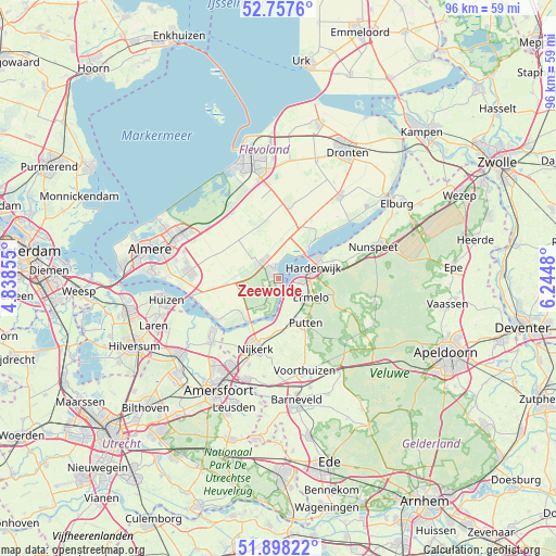
Zeewolde GPS coordinates[2]
52° 19' 48" North, 5° 32' 30.012" East
| Map corner | latitude | longitude |
|---|---|---|
| Upper-left | 52.7576°, | 4.83855° |
| Center: | 52.33°, | 5.54167° |
| Lower-right: | 51.89822°, | 6.2448° |
| Map W x H: | 95.6×95.6 km | = 59.4×59.4mi |
| max Lat: | 53.48025° ⇑32.8% North |
| Zeewolde: | 52.33° |
| min Lat: | ⇓67.2% South 50.76917° |
| min Long | Zeewolde | max Long |
| 3.38611° | 5.54167° | 7.16528° |
| W 44.8%⇐ | ⇒55.2% E |
Elevation
Elevation of Zeewolde is -1 m = -3 ft, and this is 16 m = 52 ft below average elevation for this country.
| Max E: |
203 m = 666 ft | 96.1% |
| Avg. | 15 m = 49 ft | |
| Zeewolde | -1 m = -3 ft | |
Min E: |
-6 m = -20 ft | 3.9% |
See also: Netherlands elevation on elevation.city.
Geographical zone
Zeewolde is located in North temperate zone (between Tropic of Cancer and the Arctic Circle). Distance of this North polar circle is 1582.6 km =983.4 mi to North.| Distance of | km | miles | from Zeewolde |
|---|---|---|---|
| North Pole | 4188.5 | 2602.6 | to North |
| Arctic Circle | 1582.6 | 983.4 | to North |
| Tropic Cancer | 3212.6 | 1996.2 | to South |
| Equator | 5818.6 | 3615.5 | to South |


Nearby cities:
15 places around Zeewolde: (largest is in red/bold)
• Appel
15.8 km =9.8 mi,  180°
180°
• Bunschoten
14.7 km =9.1 mi,  228°
228°
• Corlaer
13.7 km =8.5 mi,  202°
202°
• Doornsteeg
12.6 km =7.8 mi,  208°
208°
• Eemdijk
16.6 km =10.3 mi,  239°
239°
• Ermelo
6.5 km =4 mi,  122°
122°
• Garderen
16.1 km =10 mi,  133°
133°
• Harderwijk
5.5 km =3.4 mi,  76°
76°
• Hulshorst
13.4 km =8.3 mi,  73°
73°
• Nijkerk
12.8 km =8 mi, 197°
• Nijkerkerveen
15.9 km =9.9 mi, 198°
• Putten
9 km =5.6 mi,  150°
150°
• Spakenburg
14.9 km =9.3 mi, 233°
• Voorthuizen
16.5 km =10.3 mi,  164°
164°
• Zwartebroek
17 km =10.6 mi,  188°
188°
Sources, notices
• [Note1] Compared only with cities in Netherlands existing in our database
• [Src1] Map data: © OpenStreetMap contributors (CC-BY-SA)
• [Src2] Other city data from geonames.org with taken over terms of usage.
• [Src3] Geographical zone / Annual Mean Temperature by Robert A. Rohde @ Wikipedia
