Doornsteeg geodata
Doornsteeg (Gelderland) is a populated place; located in Netherlands in Europe/Amsterdam (GMT+2) time zone. With population of 5,400 people, there are 448 cities with bigger population in this country. Compared to other cities in Netherlands, 62.9% of cities are located further ↓South; 58.8% of cities are located further →East and 96.1% of cities have higher elevation than Doornsteeg. Note1


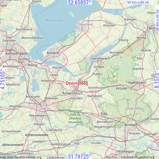
Doornsteeg GPS coordinates[2]
52° 13' 48" North, 5° 27' 15.012" East
| Map corner | latitude | longitude |
|---|---|---|
| Upper-left | 52.65857°, | 4.75105° |
| Center: | 52.23°, | 5.45417° |
| Lower-right: | 51.79725°, | 6.1573° |
| Map W x H: | 95.8×95.8 km | = 59.5×59.5mi |
| max Lat: | 53.48025° ⇑37.1% North |
| Doornsteeg: | 52.23° |
| min Lat: | ⇓62.9% South 50.76917° |
| min Long | Doornsteeg | max Long |
| 3.38611° | 5.45417° | 7.16528° |
| W 41.2%⇐ | ⇒58.8% E |
Elevation
Elevation of Doornsteeg is -1 m = -3 ft, and this is 16 m = 52 ft below average elevation for this country.
| Max E: |
203 m = 666 ft | 96.1% |
| Avg. | 15 m = 49 ft | |
| Doornsteeg | -1 m = -3 ft | |
Min E: |
-6 m = -20 ft | 3.9% |
See also: Netherlands elevation on elevation.city.
Geographical zone
Doornsteeg is located in North temperate zone (between Tropic of Cancer and the Arctic Circle). Distance of this North polar circle is 1593.7 km =990.3 mi to North.| Distance of | km | miles | from Doornsteeg |
|---|---|---|---|
| North Pole | 4199.6 | 2609.5 | to North |
| Arctic Circle | 1593.7 | 990.3 | to North |
| Tropic Cancer | 3201.5 | 1989.3 | to South |
| Equator | 5807.4 | 3608.5 | to South |


Nearby cities:
15 places around Doornsteeg: (largest is in red/bold)
• Amersfoort
9.5 km =5.9 mi,  208°
208°
• Appel
7.5 km =4.7 mi,  128°
128°
• Bunschoten
5.3 km =3.3 mi,  285°
285°
• Corlaer
1.7 km =1.1 mi,  153°
153°
• Eemdijk
8.9 km =5.5 mi, 288°
• Hoogland
7.6 km =4.7 mi,  226°
226°
• Langenoord
6.9 km =4.3 mi, 226°
• Leusden
10.9 km =6.8 mi,  187°
187°
• Nijkerk
2.4 km =1.5 mi,  117°
117°
• Nijkerkerveen
4 km =2.5 mi,  167°
167°
• Putten
10.9 km =6.8 mi,  72°
72°
• Randenbroek
9.7 km =6 mi,  201°
201°
• Spakenburg
6.4 km =4 mi, 290°
• Terschuur
8.4 km =5.2 mi, 149°
• Zwartebroek
6.6 km =4.1 mi, 148°
Sources, notices
• [Note1] Compared only with cities in Netherlands existing in our database
• [Src1] Map data: © OpenStreetMap contributors (CC-BY-SA)
• [Src2] Other city data from geonames.org with taken over terms of usage.
• [Src3] Geographical zone / Annual Mean Temperature by Robert A. Rohde @ Wikipedia
