Son en Breugel geodata
Son en Breugel (North Brabant) is a seat of a second-order administrative division; located in Netherlands in Europe/Amsterdam (GMT+2) time zone. In our database, there are 1836 cities with bigger population. Compared to other cities in Netherlands, 79.5% of cities are located further ↑North; 56.8% of cities are located further →East and 77.1% of cities have lower elevation than Son en Breugel. Note1


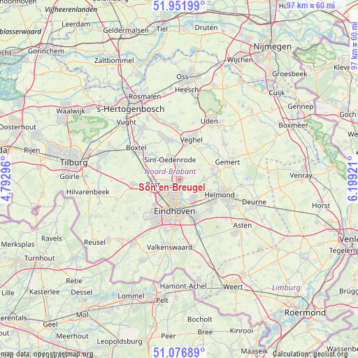
Son en Breugel GPS coordinates[2]
51° 30' 59.544" North, 5° 29' 45.888" East
| Map corner | latitude | longitude |
|---|---|---|
| Upper-left | 51.95199°, | 4.79296° |
| Center: | 51.51654°, | 5.49608° |
| Lower-right: | 51.07689°, | 6.19921° |
| Map W x H: | 97.3×97.3 km | = 60.5×60.5mi |
| max Lat: | 53.48025° ⇑79.5% North |
| Son en Breugel: | 51.51654° |
| min Lat: | ⇓20.5% South 50.76917° |
| min Long | Son en Breugel | max Long |
| 3.38611° | 5.49608° | 7.16528° |
| W 43.2%⇐ | ⇒56.8% E |
Elevation
Elevation of Son en Breugel is 19 m = 62 ft, and this is 4 m = 13 ft above average elevation for this country.
| Max E: |
203 m = 666 ft | 22.9% |
| Son en Breugel | 19 m 62 ft | |
| Avg. | 15 m = 49 ft | |
Min E: |
-6 m = -20 ft | 77.1% |
See also: Netherlands elevation on elevation.city.
Geographical zone
Son en Breugel is located in North temperate zone (between Tropic of Cancer and the Arctic Circle). Distance of this North polar circle is 1673.1 km =1039.6 mi to North.| Distance of | km | miles | from Son en Breugel |
|---|---|---|---|
| North Pole | 4279 | 2658.8 | to North |
| Arctic Circle | 1673.1 | 1039.6 | to North |
| Tropic Cancer | 3122.2 | 1940 | to South |
| Equator | 5728.1 | 3559.3 | to South |


Nearby cities:
15 places around Son en Breugel: (largest is in red/bold)
• Breugel
1 km =0.6 mi,  84°
84°
• Eckart
4.8 km =3 mi,  181°
181°
• Eerschot
6 km =3.7 mi,  344°
344°
• Gerwen
5.5 km =3.4 mi,  122°
122°
• Heesterakker
3.4 km =2.1 mi, 179°
• Jagershoef
5.2 km =3.2 mi,  202°
202°
• Mariahout
5.9 km =3.7 mi,  62°
62°
• Nederwetten
3.4 km =2.1 mi,  145°
145°
• Nijnsel
3.9 km =2.4 mi,  346°
346°
• Sint-Oedenrode
6.2 km =3.9 mi, 336°
• Son
0.6 km =0.4 mi, 201°
• Speelheide
6.4 km =4 mi,  259°
259°
• Vaartbroek
4.1 km =2.5 mi, 178°
• Vlokhoven
5.6 km =3.5 mi,  189°
189°
• Woenselse Heide
4.2 km =2.6 mi,  208°
208°
Sources, notices
• [Note1] Compared only with cities in Netherlands existing in our database
• [Src1] Map data: © OpenStreetMap contributors (CC-BY-SA)
• [Src2] Other city data from geonames.org with taken over terms of usage.
• [Src3] Geographical zone / Annual Mean Temperature by Robert A. Rohde @ Wikipedia
