Oudeschild geodata
Oudeschild (North Holland) is a populated place; located in Netherlands in Europe/Amsterdam (GMT+2) time zone. With population of 1,220 people, there are 1277 cities with bigger population in this country. Compared to other cities in Netherlands, 86.8% of cities are located further ↓South; 78.1% of cities are located further →East and 74.9% of cities have higher elevation than Oudeschild. Note1


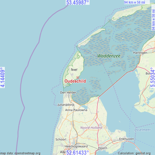
Oudeschild GPS coordinates[2]
53° 2' 21.012" North, 4° 50' 49.992" East
| Map corner | latitude | longitude |
|---|---|---|
| Upper-left | 53.45987°, | 4.14409° |
| Center: | 53.03917°, | 4.84722° |
| Lower-right: | 52.61433°, | 5.55034° |
| Map W x H: | 94×94 km | = 58.4×58.4mi |
| max Lat: | 53.48025° ⇑13.2% North |
| Oudeschild: | 53.03917° |
| min Lat: | ⇓86.8% South 50.76917° |
| min Long | Oudeschild | max Long |
| 3.38611° | 4.84722° | 7.16528° |
| W 21.9%⇐ | ⇒78.1% E |
Elevation
Elevation of Oudeschild is 2 m = 7 ft, and this is 13 m = 43 ft below average elevation for this country.
| Max E: |
203 m = 666 ft | 74.9% |
| Avg. | 15 m = 49 ft | |
| Oudeschild | 2 m = 7 ft | |
Min E: |
-6 m = -20 ft | 25.1% |
See also: Netherlands elevation on elevation.city.
Geographical zone
Oudeschild is located in North temperate zone (between Tropic of Cancer and the Arctic Circle). Distance of this North polar circle is 1503.8 km =934.4 mi to North.| Distance of | km | miles | from Oudeschild |
|---|---|---|---|
| North Pole | 4109.7 | 2553.6 | to North |
| Arctic Circle | 1503.8 | 934.4 | to North |
| Tropic Cancer | 3291.5 | 2045.2 | to South |
| Equator | 5897.4 | 3664.5 | to South |


Nearby cities:
15 places around Oudeschild: (largest is in red/bold)
• 't Zand
23.3 km =14.5 mi,  195°
195°
• Breezand
16.8 km =10.4 mi,  189°
189°
• Callantsoog
24.4 km =15.2 mi, 204°
• De Cocksdorp
13.2 km =8.2 mi,  6°
6°
• De Koog
8.7 km =5.4 mi,  318°
318°
• Den Burg
3.7 km =2.3 mi,  296°
296°
• Den Helder
10.6 km =6.6 mi,  213°
213°
• Den Oever
17 km =10.6 mi,  133°
133°
• Hippolytushoef
16.6 km =10.3 mi,  152°
152°
• Oosterend
5.4 km =3.4 mi,  20°
20°
• Oudesluis
22.9 km =14.2 mi, 186°
• Slootdorp
23.4 km =14.5 mi,  159°
159°
• Westerland
17 km =10.6 mi, 161°
• Wieringerwaard
22.6 km =14 mi,  176°
176°
• Wieringerwerf
24.1 km =15 mi, 150°
Sources, notices
• [Note1] Compared only with cities in Netherlands existing in our database
• [Src1] Map data: © OpenStreetMap contributors (CC-BY-SA)
• [Src2] Other city data from geonames.org with taken over terms of usage.
• [Src3] Geographical zone / Annual Mean Temperature by Robert A. Rohde @ Wikipedia
