Luyksgestel geodata
Luyksgestel (North Brabant) is a populated place; located in Netherlands in Europe/Amsterdam (GMT+2) time zone. With population of 2,465 people, there are 849 cities with bigger population in this country. Compared to other cities in Netherlands, 89.5% of cities are located further ↑North; 62.8% of cities are located further →East and 91.5% of cities have lower elevation than Luyksgestel. Note1


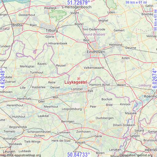
Luyksgestel GPS coordinates[2]
51° 17' 21.012" North, 5° 19' 24.996" East
| Map corner | latitude | longitude |
|---|---|---|
| Upper-left | 51.72679°, | 4.62049° |
| Center: | 51.28917°, | 5.32361° |
| Lower-right: | 50.84733°, | 6.02674° |
| Map W x H: | 97.8×97.8 km | = 60.8×60.8mi |
| max Lat: | 53.48025° ⇑89.5% North |
| Luyksgestel: | 51.28917° |
| min Lat: | ⇓10.5% South 50.76917° |
| min Long | Luyksgestel | max Long |
| 3.38611° | 5.32361° | 7.16528° |
| W 37.2%⇐ | ⇒62.8% E |
Elevation
Elevation of Luyksgestel is 37 m = 121 ft, and this is 22 m = 72 ft above average elevation for this country.
| Max E: |
203 m = 666 ft | 8.5% |
| Luyksgestel | 37 m 121 ft | |
| Avg. | 15 m = 49 ft | |
Min E: |
-6 m = -20 ft | 91.5% |
See also: Netherlands elevation on elevation.city.
Geographical zone
Luyksgestel is located in North temperate zone (between Tropic of Cancer and the Arctic Circle). Distance of this North polar circle is 1698.4 km =1055.3 mi to North.| Distance of | km | miles | from Luyksgestel |
|---|---|---|---|
| North Pole | 4304.2 | 2674.5 | to North |
| Arctic Circle | 1698.4 | 1055.3 | to North |
| Tropic Cancer | 3096.9 | 1924.3 | to South |
| Equator | 5702.8 | 3543.6 | to South |


Nearby cities:
15 places around Luyksgestel: (largest is in red/bold)
• Bergeijk
4.1 km =2.5 mi,  35°
35°
• Bladel
11.3 km =7 mi,  320°
320°
• Borkel
8.2 km =5.1 mi,  83°
83°
• Casteren
13.4 km =8.3 mi,  333°
333°
• Dommelen
10 km =6.2 mi,  50°
50°
• Duizel
9 km =5.6 mi,  348°
348°
• Eersel
7.6 km =4.7 mi,  357°
357°
• Geenhoven
12.3 km =7.6 mi, 50°
• Hapert
9.9 km =6.2 mi, 332°
• Hoogeloon
12.6 km =7.8 mi,  342°
342°
• Riethoven
8.5 km =5.3 mi,  31°
31°
• Steensel
9.9 km =6.2 mi,  11°
11°
• Valkenswaard
11.7 km =7.3 mi, 54°
• Weebosch
2.9 km =1.8 mi, 316°
• Westerhoven
7 km =4.3 mi, 46°
Sources, notices
• [Note1] Compared only with cities in Netherlands existing in our database
• [Src1] Map data: © OpenStreetMap contributors (CC-BY-SA)
• [Src2] Other city data from geonames.org with taken over terms of usage.
• [Src3] Geographical zone / Annual Mean Temperature by Robert A. Rohde @ Wikipedia
