Handel geodata
Handel (North Brabant) is a populated place; located in Netherlands in Europe/Amsterdam (GMT+2) time zone. With population of 1,310 people, there are 1233 cities with bigger population in this country. Compared to other cities in Netherlands, 75% of cities are located further ↑North; 52.3% of cities are located further ←West and 78.8% of cities have lower elevation than Handel. Note1


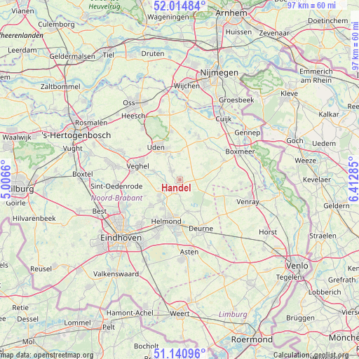
Handel GPS coordinates[2]
51° 34' 48" North, 5° 42' 34.992" East
| Map corner | latitude | longitude |
|---|---|---|
| Upper-left | 52.01484°, | 5.0066° |
| Center: | 51.58°, | 5.70972° |
| Lower-right: | 51.14096°, | 6.41285° |
| Map W x H: | 97.2×97.2 km | = 60.4×60.4mi |
| max Lat: | 53.48025° ⇑75% North |
| Handel: | 51.58° |
| min Lat: | ⇓25% South 50.76917° |
| min Long | Handel | max Long |
| 3.38611° | 5.70972° | 7.16528° |
| W 52.3%⇐ | ⇒47.7% E |
Elevation
Elevation of Handel is 20 m = 66 ft, and this is 5 m = 16 ft above average elevation for this country.
| Max E: |
203 m = 666 ft | 21.2% |
| Handel | 20 m 66 ft | |
| Avg. | 15 m = 49 ft | |
Min E: |
-6 m = -20 ft | 78.8% |
See also: Netherlands elevation on elevation.city.
Geographical zone
Handel is located in North temperate zone (between Tropic of Cancer and the Arctic Circle). Distance of this North polar circle is 1666 km =1035.2 mi to North.| Distance of | km | miles | from Handel |
|---|---|---|---|
| North Pole | 4271.9 | 2654.4 | to North |
| Arctic Circle | 1666 | 1035.2 | to North |
| Tropic Cancer | 3129.2 | 1944.4 | to South |
| Equator | 5735.2 | 3563.7 | to South |


Nearby cities:
15 places around Handel: (largest is in red/bold)
• Bakel
8.8 km =5.5 mi,  166°
166°
• Beek
7.7 km =4.8 mi,  222°
222°
• Boekel
3.5 km =2.2 mi,  317°
317°
• Boerdonk
6.3 km =3.9 mi,  248°
248°
• De Mortel
4.4 km =2.7 mi,  181°
181°
• De Rips
7.7 km =4.8 mi,  115°
115°
• Donk
7.2 km =4.5 mi,  230°
230°
• Doonheide
1.8 km =1.1 mi, 215°
• Elsendorp
4.1 km =2.5 mi,  88°
88°
• Erp
7.4 km =4.6 mi,  287°
287°
• Gemert
3 km =1.9 mi,  206°
206°
• Keldonk
8.7 km =5.4 mi,  274°
274°
• Odiliapeel
7 km =4.3 mi,  357°
357°
• Venhorst
3.7 km =2.3 mi,  31°
31°
• Volkel
7.9 km =4.9 mi,  331°
331°
Sources, notices
• [Note1] Compared only with cities in Netherlands existing in our database
• [Src1] Map data: © OpenStreetMap contributors (CC-BY-SA)
• [Src2] Other city data from geonames.org with taken over terms of usage.
• [Src3] Geographical zone / Annual Mean Temperature by Robert A. Rohde @ Wikipedia
