Donk geodata
Donk (North Brabant) is a populated place; located in Netherlands in Europe/Amsterdam (GMT+2) time zone. With population of 3,580 people, there are 658 cities with bigger population in this country. Compared to other cities in Netherlands, 77.8% of cities are located further ↑North; 51.2% of cities are located further →East and 70.6% of cities have lower elevation than Donk. Note1


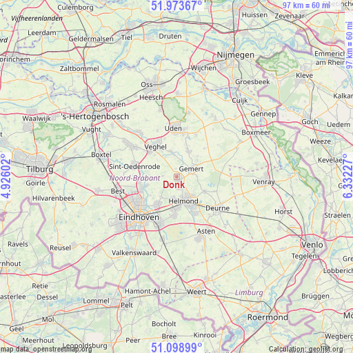
Donk GPS coordinates[2]
51° 32' 18.348" North, 5° 37' 44.904" East
| Map corner | latitude | longitude |
|---|---|---|
| Upper-left | 51.97367°, | 4.92602° |
| Center: | 51.53843°, | 5.62914° |
| Lower-right: | 51.09899°, | 6.33227° |
| Map W x H: | 97.3×97.3 km | = 60.5×60.5mi |
| max Lat: | 53.48025° ⇑77.8% North |
| Donk: | 51.53843° |
| min Lat: | ⇓22.2% South 50.76917° |
| min Long | Donk | max Long |
| 3.38611° | 5.62914° | 7.16528° |
| W 48.8%⇐ | ⇒51.2% E |
Elevation
Elevation of Donk is 15 m = 49 ft, and this is 0 m = 0 ft above average elevation for this country.
| Max E: |
203 m = 666 ft | 29.4% |
| Donk | 15 m 49 ft | |
| Avg. | 15 m = 49 ft | |
Min E: |
-6 m = -20 ft | 70.6% |
See also: Netherlands elevation on elevation.city.
Geographical zone
Donk is located in North temperate zone (between Tropic of Cancer and the Arctic Circle). Distance of this North polar circle is 1670.6 km =1038.1 mi to North.| Distance of | km | miles | from Donk |
|---|---|---|---|
| North Pole | 4276.5 | 2657.3 | to North |
| Arctic Circle | 1670.6 | 1038.1 | to North |
| Tropic Cancer | 3124.6 | 1941.5 | to South |
| Equator | 5730.5 | 3560.8 | to South |


Nearby cities:
15 places around Donk: (largest is in red/bold)
• Aarle-Rixtel
3.3 km =2.1 mi,  168°
168°
• Beek
1.1 km =0.7 mi,  163°
163°
• Boekel
7.9 km =4.9 mi,  23°
23°
• Boerdonk
2.3 km =1.4 mi,  352°
352°
• De Mortel
5.5 km =3.4 mi,  88°
88°
• Doonheide
5.5 km =3.4 mi,  55°
55°
• Erp
7 km =4.3 mi, 347°
• Gemert
4.6 km =2.9 mi,  65°
65°
• Gerwen
7.1 km =4.4 mi,  220°
220°
• Handel
7.2 km =4.5 mi,  50°
50°
• Helmond
6.7 km =4.2 mi, 160°
• Keldonk
6.2 km =3.9 mi,  330°
330°
• Lieshout
3.1 km =1.9 mi,  229°
229°
• Mariahout
3.9 km =2.4 mi,  273°
273°
• Zondveld
6.4 km =4 mi,  308°
308°
Sources, notices
• [Note1] Compared only with cities in Netherlands existing in our database
• [Src1] Map data: © OpenStreetMap contributors (CC-BY-SA)
• [Src2] Other city data from geonames.org with taken over terms of usage.
• [Src3] Geographical zone / Annual Mean Temperature by Robert A. Rohde @ Wikipedia
