Langenoord geodata
Langenoord (Utrecht) is a populated place; located in Netherlands in Europe/Amsterdam (GMT+2) time zone. With population of 1,695 people, there are 1045 cities with bigger population in this country. Compared to other cities in Netherlands, 59.2% of cities are located further ↓South; 61.4% of cities are located further →East and 74.9% of cities have higher elevation than Langenoord. Note1


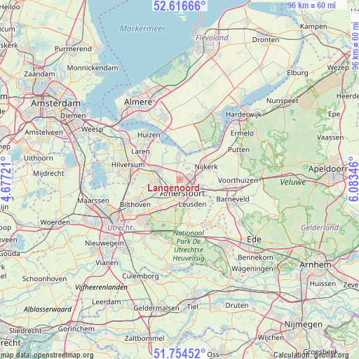
Langenoord GPS coordinates[2]
52° 11' 15.648" North, 5° 22' 49.224" East
| Map corner | latitude | longitude |
|---|---|---|
| Upper-left | 52.61666°, | 4.67721° |
| Center: | 52.18768°, | 5.38034° |
| Lower-right: | 51.75452°, | 6.08346° |
| Map W x H: | 95.9×95.9 km | = 59.6×59.6mi |
| max Lat: | 53.48025° ⇑40.8% North |
| Langenoord: | 52.18768° |
| min Lat: | ⇓59.2% South 50.76917° |
| min Long | Langenoord | max Long |
| 3.38611° | 5.38034° | 7.16528° |
| W 38.6%⇐ | ⇒61.4% E |
Elevation
Elevation of Langenoord is 2 m = 7 ft, and this is 13 m = 43 ft below average elevation for this country.
| Max E: |
203 m = 666 ft | 74.9% |
| Avg. | 15 m = 49 ft | |
| Langenoord | 2 m = 7 ft | |
Min E: |
-6 m = -20 ft | 25.1% |
See also: Netherlands elevation on elevation.city.
Geographical zone
Langenoord is located in North temperate zone (between Tropic of Cancer and the Arctic Circle). Distance of this North polar circle is 1598.4 km =993.2 mi to North.| Distance of | km | miles | from Langenoord |
|---|---|---|---|
| North Pole | 4204.3 | 2612.4 | to North |
| Arctic Circle | 1598.4 | 993.2 | to North |
| Tropic Cancer | 3196.8 | 1986.4 | to South |
| Equator | 5802.7 | 3605.6 | to South |


Nearby cities:
15 places around Langenoord: (largest is in red/bold)
• Amersfoort
3.7 km =2.3 mi,  172°
172°
• Baarn
6.9 km =4.3 mi,  292°
292°
• Bunschoten
6.2 km =3.9 mi,  359°
359°
• Corlaer
6.6 km =4.1 mi,  61°
61°
• Doornsteeg
6.9 km =4.3 mi,  46°
46°
• Eemdijk
8.2 km =5.1 mi,  335°
335°
• Hoogland
0.7 km =0.4 mi,  218°
218°
• Leusden
7.1 km =4.4 mi,  150°
150°
• Nijkerk
8.1 km =5 mi, 63°
• Nijkerkerveen
5.9 km =3.7 mi,  82°
82°
• Randenbroek
4.6 km =2.9 mi,  161°
161°
• Soest
6.3 km =3.9 mi,  255°
255°
• Soestdijk
6.5 km =4 mi,  273°
273°
• Spakenburg
7 km =4.3 mi,  352°
352°
• Zwartebroek
8.5 km =5.3 mi,  96°
96°
Sources, notices
• [Note1] Compared only with cities in Netherlands existing in our database
• [Src1] Map data: © OpenStreetMap contributors (CC-BY-SA)
• [Src2] Other city data from geonames.org with taken over terms of usage.
• [Src3] Geographical zone / Annual Mean Temperature by Robert A. Rohde @ Wikipedia
