Vik geodata
Vik (Nordland) is a seat of a second-order administrative division; located in Norway in Europe/Oslo (GMT+2) time zone. With population of 365 people, there are 473 cities with bigger population in this country. Compared to other cities in Norway, 83.2% of cities are located further ↓South; 82.3% of cities are located further ←West and 58.2% of cities have higher elevation than Vik. Note1


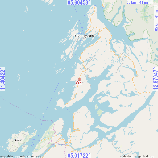
Vik GPS coordinates[2]
65° 18' 45.144" North, 12° 10' 2.424" East
| Map corner | latitude | longitude |
|---|---|---|
| Upper-left | 65.60458°, | 11.46422° |
| Center: | 65.31254°, | 12.16734° |
| Lower-right: | 65.01722°, | 12.87047° |
| Map W x H: | 65.3×65.3 km | = 40.6×40.6mi |
| max Lat: | 71.04137° ⇑16.8% North |
| Vik: | 65.31254° |
| min Lat: | ⇓83.2% South 58.0274° |
| min Long | Vik | max Long |
| 4.71485° | 12.16734° | 31.11066° |
| W 82.3%⇐ | ⇒17.7% E |
Elevation
Elevation of Vik is 30 m = 98 ft, and this is 74.2 m = 243 ft below average elevation for this country.
| Max E: |
897 m = 2943 ft | 58.2% |
| Avg. | 104.2 m = 342 ft | |
| Vik | 30 m = 98 ft | |
Min E: |
1 m = 3 ft | 41.8% |
See also: Norway elevation on elevation.city.
Geographical zone
Vik is located in North temperate zone (between Tropic of Cancer and the Arctic Circle). Distance of this North polar circle is 139.1 km =86.4 mi to North.| Distance of | km | miles | from Vik |
|---|---|---|---|
| North Pole | 2745 | 1705.7 | to North |
| Arctic Circle | 139.1 | 86.4 | to North |
| Tropic Cancer | 4656.2 | 2893.2 | to South |
| Equator | 7262.1 | 4512.5 | to South |


Nearby cities:
15 places around Vik: (largest is in red/bold)
• Brønnøysund
18.2 km =11.3 mi,  6°
6°
• Gladstad
41.6 km =25.8 mi,  346°
346°
• Høylandet
76.3 km =47.4 mi,  175°
175°
• Jøa
84.1 km =52.3 mi,  210°
210°
• Kolvereid
56.3 km =35 mi, 207°
• Leknes
32.1 km =19.9 mi,  222°
222°
• Mosjøen
74.8 km =46.5 mi,  38°
38°
• Namsskogan
63 km =39.1 mi,  132°
132°
• Rørvik
66.3 km =41.2 mi, 220°
• Røyrvik
80.9 km =50.3 mi, 126°
• Sandnessjøen
81.7 km =50.8 mi,  15°
15°
• Silvalen
74.8 km =46.5 mi,  4°
4°
• Terråk
26.8 km =16.7 mi,  159°
159°
• Trofors
62.3 km =38.7 mi,  66°
66°
• Vevelstad
44.6 km =27.7 mi, 16°
Sources, notices
• [Note1] Compared only with cities in Norway existing in our database
• [Src1] Map data: © OpenStreetMap contributors (CC-BY-SA)
• [Src2] Other city data from geonames.org with taken over terms of usage.
• [Src3] Geographical zone / Annual Mean Temperature by Robert A. Rohde @ Wikipedia
