Silvalen geodata
Silvalen (Nordland) is a seat of a second-order administrative division; located in Norway in Europe/Oslo (GMT+2) time zone. In our database, there are 488 cities with bigger population. Compared to other cities in Norway, 84.3% of cities are located further ↓South; 82.9% of cities are located further ←West and 100% of cities have higher elevation than Silvalen. Note1


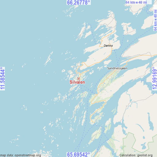
Silvalen GPS coordinates[2]
65° 58' 59.52" North, 12° 17' 18.816" East
| Map corner | latitude | longitude |
|---|---|---|
| Upper-left | 66.26778°, | 11.58544° |
| Center: | 65.9832°, | 12.28856° |
| Lower-right: | 65.69542°, | 12.99169° |
| Map W x H: | 63.6×63.6 km | = 39.5×39.5mi |
| max Lat: | 71.04137° ⇑15.7% North |
| Silvalen: | 65.9832° |
| min Lat: | ⇓84.3% South 58.0274° |
| min Long | Silvalen | max Long |
| 4.71485° | 12.28856° | 31.11066° |
| W 82.9%⇐ | ⇒17.1% E |
Elevation
Elevation of Silvalen is 1 m = 3 ft, and this is 103.2 m = 339 ft below average elevation for this country.
| Max E: |
897 m = 2943 ft | 100% |
| Avg. | 104.2 m = 342 ft | |
| Silvalen | 1 m = 3 ft | |
Min E: |
1 m = 3 ft | 0% |
See also: Norway elevation on elevation.city.
Geographical zone
Silvalen is located in North temperate zone (between Tropic of Cancer and the Arctic Circle). Distance of this North polar circle is 64.5 km =40.1 mi to North.| Distance of | km | miles | from Silvalen |
|---|---|---|---|
| North Pole | 2670.4 | 1659.3 | to North |
| Arctic Circle | 64.5 | 40.1 | to North |
| Tropic Cancer | 4730.7 | 2939.5 | to South |
| Equator | 7336.6 | 4558.8 | to South |


Nearby cities:
15 places around Silvalen: (largest is in red/bold)
• Brønnøysund
56.6 km =35.2 mi,  183°
183°
• Gladstad
37.2 km =23.1 mi,  203°
203°
• Hauknes
86.7 km =53.9 mi,  67°
67°
• Hemnesberget
65.6 km =40.8 mi, 65°
• Husøya
58.3 km =36.2 mi,  351°
351°
• Korgen
70 km =43.5 mi,  81°
81°
• Leland
30.9 km =19.2 mi, 73°
• Lurøy
54.4 km =33.8 mi,  27°
27°
• Mosjøen
44.1 km =27.4 mi,  111°
111°
• Nesna
40.7 km =25.3 mi,  53°
53°
• Sandnessjøen
16.1 km =10 mi, 74°
• Solfjellsjøen
17.2 km =10.7 mi, 30°
• Trofors
71.5 km =44.4 mi,  134°
134°
• Vevelstad
32.4 km =20.1 mi,  167°
167°
• Vik
74.8 km =46.5 mi, 184°
Sources, notices
• [Note1] Compared only with cities in Norway existing in our database
• [Src1] Map data: © OpenStreetMap contributors (CC-BY-SA)
• [Src2] Other city data from geonames.org with taken over terms of usage.
• [Src3] Geographical zone / Annual Mean Temperature by Robert A. Rohde @ Wikipedia
