Vestbygd geodata
Vestbygd (Vest-Agder) is a populated place; located in Norway in Europe/Oslo (GMT+2) time zone. With population of 1,083 people, there are 298 cities with bigger population in this country. Compared to other cities in Norway, 98.7% of cities are located further ↑North; 77.2% of cities are located further →East and 84.8% of cities have higher elevation than Vestbygd. Note1


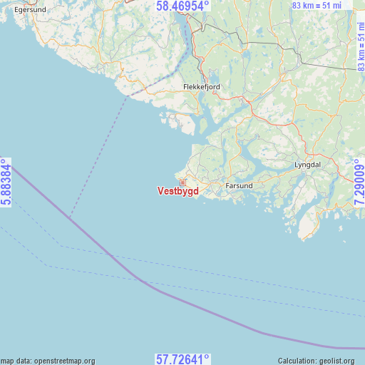
Vestbygd GPS coordinates[2]
58° 5' 59.676" North, 6° 35' 13.056" East
| Map corner | latitude | longitude |
|---|---|---|
| Upper-left | 58.46954°, | 5.88384° |
| Center: | 58.09991°, | 6.58696° |
| Lower-right: | 57.72641°, | 7.29009° |
| Map W x H: | 82.6×82.6 km | = 51.3×51.3mi |
| max Lat: | 71.04137° ⇑98.7% North |
| Vestbygd: | 58.09991° |
| min Lat: | ⇓1.3% South 58.0274° |
| min Long | Vestbygd | max Long |
| 4.71485° | 6.58696° | 31.11066° |
| W 22.8%⇐ | ⇒77.2% E |
Elevation
Elevation of Vestbygd is 8 m = 26 ft, and this is 96.2 m = 316 ft below average elevation for this country.
| Max E: |
897 m = 2943 ft | 84.8% |
| Avg. | 104.2 m = 342 ft | |
| Vestbygd | 8 m = 26 ft | |
Min E: |
1 m = 3 ft | 15.2% |
See also: Norway elevation on elevation.city.
Geographical zone
Vestbygd is located in North temperate zone (between Tropic of Cancer and the Arctic Circle). Distance of this North polar circle is 941.1 km =584.8 mi to North.| Distance of | km | miles | from Vestbygd |
|---|---|---|---|
| North Pole | 3547 | 2204 | to North |
| Arctic Circle | 941.1 | 584.8 | to North |
| Tropic Cancer | 3854.2 | 2394.9 | to South |
| Equator | 6460.1 | 4014.1 | to South |


Nearby cities:
15 places around Vestbygd: (largest is in red/bold)
• Egersund
52 km =32.3 mi,  318°
318°
• Farsund
12.8 km =8 mi,  92°
92°
• Flekkefjord
22.3 km =13.9 mi,  11°
11°
• Hauge i Dalane
32.5 km =20.2 mi,  326°
326°
• Helland
56 km =34.8 mi,  79°
79°
• Konsmo
49.6 km =30.8 mi,  65°
65°
• Liknes
32.2 km =20 mi,  42°
42°
• Lyngdal
28.7 km =17.8 mi, 81°
• Mandal
51.6 km =32.1 mi,  98°
98°
• Moi
39.7 km =24.7 mi,  357°
357°
• Sira
35.9 km =22.3 mi, 7°
• Spangereid
33.1 km =20.6 mi, 100°
• Tingvatn
48.1 km =29.9 mi,  50°
50°
• Vanse
6.2 km =3.9 mi, 91°
• Vigeland
42.2 km =26.2 mi, 92°
Sources, notices
• [Note1] Compared only with cities in Norway existing in our database
• [Src1] Map data: © OpenStreetMap contributors (CC-BY-SA)
• [Src2] Other city data from geonames.org with taken over terms of usage.
• [Src3] Geographical zone / Annual Mean Temperature by Robert A. Rohde @ Wikipedia
